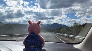
Greetings and welcome to Dinosaur Bear!
I am happy to finally present “Only you can Prevent Nuclear Explosions” – a two-part informative post which was pushed back several times due to me writing other posts in the interim.
—
Today’s post title will make a bit more sense once you start reading, but in the meantime you can just ponder it for a moment. This time around I’m going to focus on SB and I’s first New Mexico road trip, or at least our first wholly-voluntary road trip as our voyage to ABQ was technically a road trip as well. Even when we hadn’t yet reached our new home SB and I were already “discovering” a few places that we knew we wanted to visit. A couple of these were complete unknowns to us, and it is these two things which I am going to write about today. We decided that we would try to do both in one day, and while it ended up being a nearly 400 mile trip, it worked out well and we really enjoyed ourselves. Even though this was one road trip it had two distinct parts, and as such I am going to divide the post up accordingly.
“Part One – The Bomb“
Like with many one-day road trips our day started quite early, especially for us. We rolled out of bed around 4:30am and were on the road around 5:30am. Me being me I had clocked in a whopping 2.5 hours of sleep despite trying to get to bed around 11pm. Fortunately we had filled Felicia up and did most of our own preparations the night before, so aside from being tired it was an easy departure. When we first set off it was very dark still, and we could see a lot of lighting off in the direction that we were headed. Once we got up over the mountains it was clear that there was a pretty substantial thunderstorm happening around the next set of mountains far off in the distance. After making our way through a Border Control checkpoint (there are many around here) and getting up closer to the mountains we did get into some rain, but it seemed like we were mostly skirting the edge of the storm.
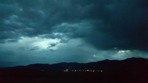
Our first destination was in Tularosa, where we joined a convoy around 7am. The convoy was being escorted by the military/police as it was going to be going into the White Sands Missile Range. The convoy ended up leaving just shortly after 8am and it wasn’t too long before we were at the edge of the base.
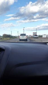
This is, of course, not a huge surprise considering that the base encompasses about 3,200 square miles. Once inside the base I don’t think we were supposed to take pictures – a rule which I mostly adhered to, but which wasn’t really being enforced anyways. In order to be a mostly good boy I avoided taking photos of all the installations, launch sites, supply depots, bunkers, tanks, radar arrays, DANGER: UNEXPLODED ORDINANCE signs, etc. that we went by and instead opted for photos of the landscape itself sans military stuff.
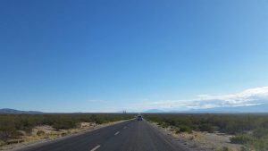
As you can see, it’s a pretty desolate area. Lots of vast open spaces and mountains – which I suppose is fitting for testing all sorts of things that go “boom” – in addition to things like vehicles and mouse traps (yes mouse traps, their words, not mine).
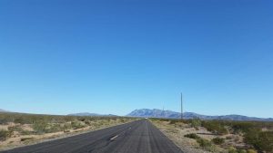
We drove for somewhere around 75-85 miles in that convoy, heading deeper and deeper into the fittingly named Jornada del Muerto (“Journey of the Dead Man”) desert. All of this was still encompassed within the missile range, but we were headed for a very particular location within the region. Eventually we crested a hill (which was dotted with a large number of observation posts) and could see a massive flatland beyond. In this next photo it’s that white strip above the car in front of us – a “strip” which is much, much larger than our limited perception initially led us to believe.
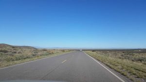
It was there, in that big ole’ flat desert valley that we reached our destination: The Trinity Site.
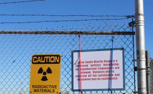
The Trinity Site, if you weren’t aware (I only was because of our past visit to Los Alamos) was where the first nuclear bomb in the history of mankind was detonated at 5:29:45 on July 16, 1945. This is the famous explosion that would later cause J. Robert Oppenheimer (of the Manhattan Project) to remark, “”Now I am become Death, the destroyer of worlds” (itself a quote from the Bhagavad Gita). The code-name “Trinity” was partially inspired by the works of John Donne and also is a reference to the Holy Trinity.
Now, while I was aware of the Trinity Site, I didn’t know specifically where it was – or let alone that you can actually visit it. It was during the final night of our westward move, during a big ole’ storm that had largely confined us to our hotel room, that I read about the Trinity Site in a NM magazine. Turns out you can visit it. You just need to drive out into the middle of a desert, have an ID for everyone in your group, some paperwork for your car, oh and also it’s only open for 16 hours per year. Small detail that last bit. Because the site is, well, frankly still radioactive (but totes safe, except not for pregnant women or children, but totes safe) and even more importantly in the middle of a massive and active bombing range, so there is the small detail of not savagely dying when you visit it.
However, during the “Trinity Site Open House” you can visit not just the rough area, but the exact spot where mankind entered the atomic age. These “open house” days occur on the first Saturday in April and October each year. If you were wondering why they don’t occur on July 16, well you go visit the “Dead Man’s Desert” in high summer and tell me how much fun that is. However, if your schedule so permits, you can visit the site. You just need to prepare for security checks (e.g. a convoy/gate clearance) and also for it to still be pretty hot, at least in October. SB and I were fortunate enough that we now live “only about 3 hours” from the site (which in NM terms means it is “very close,” apparently) and were able to make it to the October open house. These open house days are oddly difficult to find much information about, and while they are popular (~3,000 people each time, with ~5,000 people being the record – which happened on the 50th anniversary of the test) they are by no means swarmed with people.
A lot of this probably stems from the site being so remote, people being uncertain about the radiation, people not wanting to deal with security, and people just not deeming the trip worth it to see an old site in the middle of the desert. SB and I, needless to say, fell into none of those categories and were pretty excited to go. Of course, I also have to be realistic, when you get there you are greeted by what is essentially a vast nothingness – I mean this area was chosen to detonate a nuclear bomb after all.
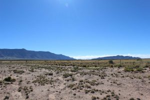
The blast site itself is surrounded by about three different layers of increasingly secure fencing. When a seemingly random spot in the middle of a desert is surrounded by fence you know something is up. The highlight, or at least most prominent feature, of the site is an obelisk which was constructed by White Sands Army personnel in 1965.
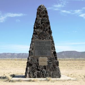
The obelisk marks the hypocenter (more commonly known as ground zero) of the blast. The “hypocenter” is the spot directly under the point of explosion, as opposed to the epicenter which is the exact point of the explosion (these terms have slightly different meanings in seismology, but we’re talking nuclear weapons here). It’s important to remember that nuclear explosions (including the two most well-known ones) generally occur well above the earth’s surface in order to maximize the blast radius/effects (with the one major exception being the later underground tests in Nevada). That is, unlike many traditional bombs which explode on impact, the nuclear bombs generally don’t impact anything, they explode prior to that point while still in free-fall. The Trinity Site test didn’t involve anything getting dropped from a plane, but I’ll explain more about that in a moment, for now just know that the obelisk above marks the exact hypocenter/ground zero of the blast.
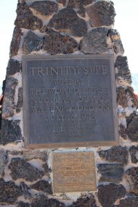
If you were curious about the plaques on the obelisk, the lower (quite-weathered) one is the one which was placed on the obelisk during its construction in 1965, the second, upper plaque (which is in better shape) dates to 1975 (the 30th anniversary of the test). Here’s a closer shot of both of them:
And, courtesy of a one radiation-seeker Tristen, here is a more pulled-back photo of the obelisk.
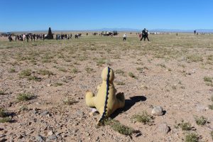
While it is really difficult to see in that photo, you can still tell you are standing in a crater when you are in the area around the obelisk, its obviously just become more muted over the years. However, I feel like that’s enough of me describing the site. Let’s look at a couple of photos of what happened there.
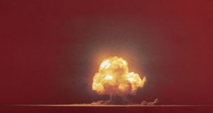
That’s the Trinity Site at just after 5:29:45 on July 16, 1945, probably not someplace you would want to be. Here’s a closer shot of the blast at a slightly different moment.
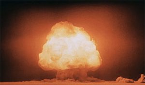
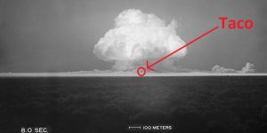
It was right around that point that the fireball reached an average temperature of 8430°K – or if you are like me and don’t understand Kelvins too well, that’s 14,700°F (8149°C). Yes, that’s 14,700 degrees – and yes that is the average, meaning that some areas were even hotter. An an aside, stainless steel is easily forged at around 2100°F – a full 12,600°F less than the heat produced by the Trinity explosion. To give you a better idea of where I would have been in all that, here’s a black and white photo of the blast with the (later) location of yours truly circled.
Now here’s the crazy thing, insofar as later nuclear (and then later still, thermonuclear) explosions go, this was was still “small.” Of course small is relative, I see nothing in those above photos that would suggest “smallness.” Yet, that’s how it is now described, with even the official Army materials stating that the “explosion did not make much of a cater.” Here’s it’s important to note, again, that Trinity was the first atomic explosion in the history of the mankind and was a resounding success – I think some of the diminutive phrasing has largely resulted from the interim 73 years and their subsequent nuclear advancements. For instance, that “not much of a crater” was actually divided into three zones. The immediate blast crater was 10′ deep, while the “inner” crater was 5′ deep by 30′ wide, and the “outer” crater zone was 4′ deep by 240′ wide. I’m not sure about you, but having also stood in the crater of traditional ordinance, Trinity’s seems pretty damn big to me. Oh, and if you were curious about the mushroom cloud? That bad boy was over 7.5 miles high. It also produced so much light that witnesses said that the entire landscape “turned bright as day” for a brief period – and the blast itself was “near blinding.”
Of course with a nuclear explosion the explosion itself is only a small fraction of the overall destruction, the heat and shock-waves (and later radiation, though they didn’t know much about that at the time of the Trinity test) are a much bigger aspect. As a reference, the Trinity explosion was felt 160 miles away, and blew out windows up to 120 miles away. For my Midwestern friends, that’s like a bomb going off in downtown Chicago and you feeling it in Indianapolis.
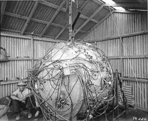
Of course all this discussion of the blast justifies some discussion of the bomb itself. The bomb, known then only as “The Gadget,” was a implosion-design plutonium bomb – in fact it was very similar to the famous “Fat Man” bomb which would later drop on Nagasaki. While “The Gadget” and “Fat Man” were undergoing simultaneous development, “The Gadget” was quite similar to the final design of “Fat Man” – just minus the detonation fusing and external ballistic casing. SB and I had seen a “Fat Man” (and “Little Boy”) replica at Los Alamos, but the Army had also trucked in another “Fat Man”/”The Gadget” (+casing/fuses) for display at the open house.
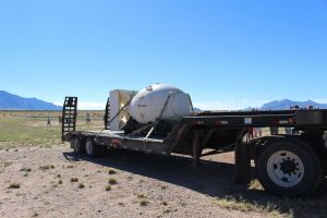
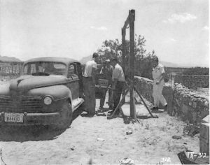
“The Gadget,” as mentioned, did not blow up right on the ground. Not only would that have stunted the blast, it would also have inadequately replicated later wartime deployment conditions. So, in order to better simulate “real world” military usage, a 100′ steel tower was constructed to house the device.
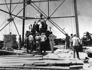
“The Gadget” was raised to the top of the 100′ tower via an electric winch – and because their were fears that it would break the winch, the Army put a truckload of mattresses – yes, mattresses under it in the event that it fell. Ah, those were simpler times, when mattresses were sufficient to buffer nuclear bombs. Fortunately there was no such break and “The Gadget” reached the top without issue.
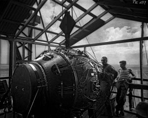
Of course in fairness to the Army, “The Gadget” was still lacking it’s plutonium core at that point, so it wouldn’t have exploded had it dropped. As for the plutonium core, that was 200 miles away up at the Los Alamos National Lab (HQ of the Manhattan Project). We’ll revisit the plutonium core in a moment. In the meantime, here’s another photo of the (nearly) completed “Gadget.”
Now, if you’re wondering about that 100′ steel tower, complete with reinforced steel pilings that went 20′ into the earth?
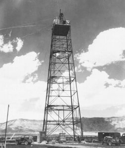
Well, I wouldn’t wonder too much about it, as it was essentially erased from existence during the blast. I mean, it’s sort of still there, even today.
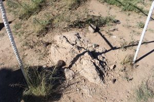
Aside from that footing there isn’t much left too see of it, and really other than that there isn’t much left period. Well, there is the famous “Trinitite” that you may have been seen being sold at some point. Trinitite is basically nuclear-explosion-created-glass which is unique to the Trinity Site (thus the name). When “The Gadget” exploded it obviously tore a Shitload (actual scientific measurement, for your information) of earth into the sky and then proceeded to heat it to 15,000° and then said earth, now molten, fell like literal hellfire all over the desert. The rain of “Trinitite” penetrated as deep as 10′ into the ground and spread as far as 1,100′ feet away. It didn’t take long (as little as 3 or 4 years) before people starting “collecting” Trinitite from the site (again, we didn’t know nearly as much about radiation then), and, for issues of safety/etc. the U.S. Atomic Energy Commission bulldozed and buried the vast majority of the Trinitite at the site in 1953. As a result, most of the Trinitite is now being sold for stupidly expensive prices (like $70 for a pebble), buried, or within an on-site bunker that “preserved” the blast-area’s surface (but which is sadly no longer open to the public). However, the key word there is most. Despite what pessimists would have you believe, you can still find Trinitite at the Trinity Site. It’s just, very, very, illegal to take it.
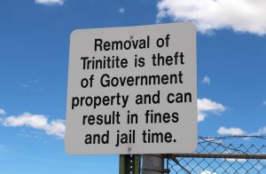
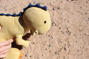
Now, that of course doesn’t stop people from taking it – however, I with a bar card in the mail, I wasn’t about to take any, plus I wouldn’t have taken any anyways, I’m not the kind of person who thinks they are so special that the rules don’t apply to them. However, you can search for it and you can pick it up (if you so desire to hold still radioactive nuclear hellfire glass) – though the armed Army personnel walking around are sure to keep an eye on you if you do. Heck, searching for the Trinitite is half the fun of visiting the site (but please leave it be). Tristen, with his T-Rex vision, was the first of us to find some.
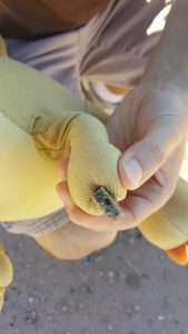
We ended up finding several large clusters of it out by the inner-most security fence. Here’s a more up-close photo of the Trinitite itself.
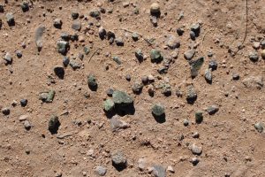
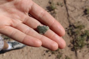
And, if you still aren’t picking it out (either due to me compressing the photos or because you were never very good at finding Waldo), here is me holding it.
Not one to risk losing an opportunity to become a radiation-powered Super Hero, Tristen also insisted on holding some.
Now, if you were wondering about sneaky ole’ Pigsten – no, despite a sizeable amount of dinosaur tantrums, he did not take any Trinitite. We specifically told him that he could not take any Trinitite. So, being Pigsten, he just took another rock from ground zero. Its a plain ole’ rock (aside from the 10x radiation) and thus wasn’t covered by our mandate. That boy. So for the rest of the day Pig had to tote Pigsten, Broli, and a radioactive rock around in his backpack. We also found a flower that had either broken off or been stepped on in ground zero (about 10′ from the obelisk) and we took that too, but more on that in a bit.
Aside from searching for Trinitite and checking out the “Fat Man” replica, they do have some NPS Rangers on site to answer questions (On December 21, 1965, the 51,500-acre site was declared a National Historic Landmark district, and on October 15, 1966, was listed on the National Register of Historic Places), as well as some Army personnel to let you play with Geiger counters and to keep you from being stupid courtesy of heavy firearms. They also put up informative signs and photos. Around the inner fence they also have some time-lapsed photos of the blast, which I thought were really cool. Here are a couple from the first .006 – .100 seconds of the explosion:
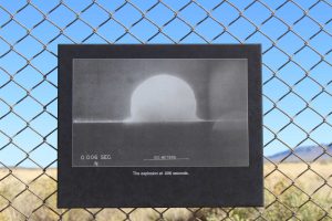
The explosion at .006 seconds.
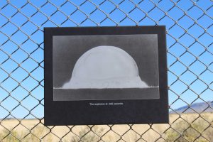
The explosion at .025 seconds.
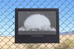
The explosion at .053 seconds.
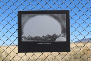
The explosion at .100 seconds.
Alternative title: “Taco’s anus after eating a whole habanero pepper in 2011.”
Aside from the historical information and markers, you also get to take in the beautiful (to me, at least) NM countryside – which coincidentally is still inside a massive bombing area (the side road that takes you out to the site is dotted with tanks and lots of very large bunkers).
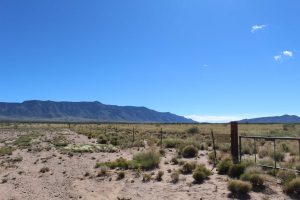
We were quite fortunate that it was a nice day, as it would have been really muddy if it had been raining – or even, worse – a massive sandstorm if it was windy (it did end up getting windy that day, but more on that latter).
In addition to “ground zero” you can also take a bus on a 2 mile ride over to the McDonald Ranch House, the sole (former) residence in the region. Don’t worry about the occupants, they were forced out courtesy of Uncle Sam over three years prior to the test (and never got their property back because muh’ freedoms).
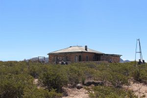
The McDonald Ranch house, build in 1913, is significant because – as the chief nearby structure – it became the “on site” HQ for Manhattan Project Workers and was ultimately where the plutonium core I spoke about above was assembled. Because these were the good ole’ days, a “clean room” was established by taping plastic over the windows and writing “do not open this door” on a couple of the doors – ah, simpler times. But seriously, they assembled volatile plutonium worth over one billion dollars (in 1945 currency, no less) in a side room of a ranch house with plastic sheets duct-taped to the windows.
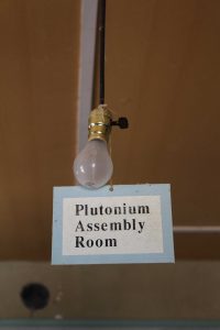
The home has been renovated twice (most substantially in 1984, kinda coincidental that), with the goal of keeping it as close to its Manhattan Project appearance as possible (inclusive of small details such as the aforementioned writing on the doors). You can move throughout the entire ground floor of the home, and each room has either been recreated – such as work benches in the plutonium room:
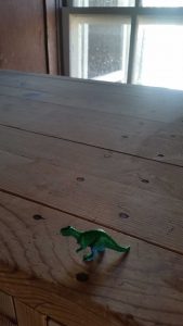
Or has informative signs/period-letters (including the letter by Leó Szilárd and Albert Einstein which was what, at least partially, convinced President Roosevelt to enter the U.S. into the nuclear arms race) on display. History aside, it’s also just a really cool old house.
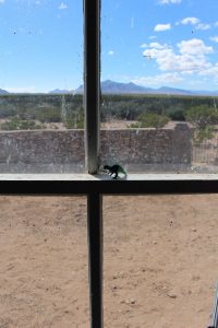
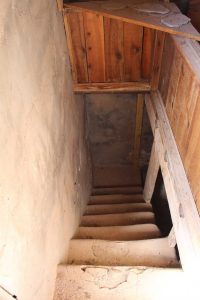
The only part of the house you can’t go into is the cellar area, which is probably haunted a.f. anyways. 😛
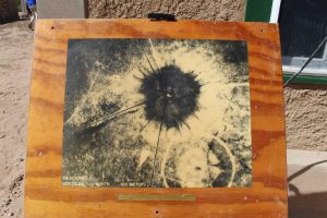
Outside the house they had another Ranger tent, as well as more signs and photos, such as this really cool aerial one of the blast site 28 hours after detonation:
In addition to the house itself, there are some ruins around it which not only add to the scenery, but which remind you of what happened there.
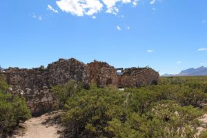
You might be wondering how in the world the house survived when it was only two miles away? Well, make no mistake – it got hit pretty hard and a lot of the “soft” parts were damaged, but if you remember from my discussion of the blast above, the intense explosive damage was fairly localized (the bombings in Japan were similar, it was the other aspects of the blast which did the most damage), though other buildings such as the barn were damaged to the point that they later collapsed. Most of why the house (sort of) withstood the blast was because, well, it was a well-made ranch house in the middle of the freaking Jornada del Muerto. That said, any living creature in the house still died terribly (poor mice).
In fact a lot of the damage to the house and property came from the subsequent years of abandonment, though recent renovations have tried to restore it to what it looked like at the time – which wasn’t much, to be fair, but it was still a home.
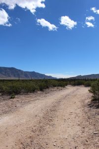
Some of the original wreckage is still there, even after all this time.
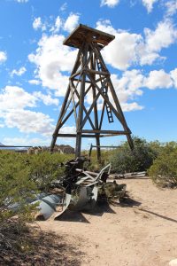
Overall I thought it was in a very scenic area, as did Pigsten.
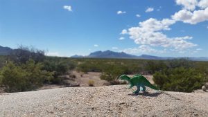
It’s easy to forget as you walk around the property that the first nuclear blast in history occurred just 2 miles away. That brings me back to the plutonium core – from which the McDonald Ranch House gains its fame. As you will recall, “The Gadget” was originally mounted on its tower sans plutonium core (for safety reasons). So, when the day came, they needed to transport it the 2 miles through the desert over to the site itself.
And how did they do that? They did what any good ole’ boy would do and threw it in the back of a pickup truck and drove it through the countryside. No seriously, they put the volatile plutonium worth approximately 1 billion dollars (again, in 1945 currency) in the back of a Chrysler Plymouth truck and drove it to the tower.
Now SB and I didn’t have the luxury of riding in a Chrysler Plymouth, though we did get to make the 2 mile journey in an Army bus which dates to roughly the same period. 🙂
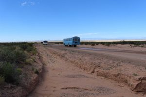
After we made it back to the parking area we decided that we’d seen all that we wanted to see and so we had a snack and then Felicia began taking us the 17 miles up to the northern “Stallion” gate of the White Sands Missile Range. Here it is worth noting that all of this was entirely free – yes, if you can make the trek, you don’t have to pay anything to visit the site! I mean, you absorb all that “sweet sweet radiation” (Tristen’s words) but fiscally, no cost.
As we were leaving the base we were met with a sizeable group of protesters from the nearby area (mostly from Socorro, I think). We had seen a smaller group of them when we’d joined the convoy that morning, but at the northern gate there were a lot more of them. They were handing out fliers and I took one because I had read about the protesters in advance. They are part of the “Tularosa Basin Downwinders Consortium” (TBDC) which is a grassroots organization founded in 2005 (though earlier groups predate this one) which basically hopes to hold the government accountable for the amount of radiation that people near the Trinity Site were exposed to with absolutely no consent, prior warning, or timely subsequent explanation (in fact, due to issues of secrecy, all the public information was either intentionally misleading or an outright lie for a while). Keeping in mind that the military grossly misunderstood (or chose to misrepresent) the vast implications of fallout (both at Trinity, Japan, and later test sites) here are some stats courtesy of TBDC, brackets are my comments.
1) There were families living as close as 12 miles from the blast site, and thousands more within a 50 mile radius [and none were warned].
2) Plutonium has a half life of 24,000 years and radioactive ash fell from the sky over a vast area [far further than the Trinitite].
3) As of the Trinity detonation, most of the small villages around the site had no running water and instead got their water from holding ponds, cisterns, and ditches – all of which were exposed to fallout.
4) There were no real grocery stores in the area – all food came from the farms and was either locally raised, harvested, or grown there. All food (plant and animal alike) was exposed to fallout.
5) The U.S. government has been compensating the “Downwinders” of the Nevada Test Site [the nuclear test site most people think of, that or Bikini Atoll] since 1950 via the “Radiation Exposure Compensation Act” (RECA). The “Downwinders” of New Mexico have never received any compensation or recovery for their exposure to the Trinity blast. The fund has paid out over 2.25 billion dollars to victims elsewhere. [“Fun” Taco Fact: some of the blasts at the Nevada Test Site irradiated as many as 13 million people, some as far away as Indiana.]
The TBDC aren’t a “forgotten” or “passive” group either, they even testified before the U.S. Senate on June 27, 2018. They are actively working to get the U.S. Government to officially admit that it exposed basically the entire Tularosa Basin to radiation as a result of the Trinity blast, and to pay the due compensation as a result. If you are interested in supporting TBDC’s mission, please check out their website – they didn’t ask me to write this to my massive audience of 1.4 people, I’m doing it because I think they have a good cause.
Funnily enough, right next to the TBDC protesters were people holding up signs telling you where to go to buy Trinitite – this right outside of the military base. Of course they weren’t selling any, just telling you where you could, you know, totally maybe get some. 😉
After we passed by the gate, protesters, and totes-not-Trinitite-sellers, we continued east to the next part of our road trip!
“Part Two – The Bear”
If nuclear bombs, irradiated populations, and death on an unprecedented scale aren’t your cup of tea, you might like this next Part a lot more, as it deals with a symbol of saving life as opposed to annihilating it. As mentioned, we were now eastbound and back into non-military-escort territory.
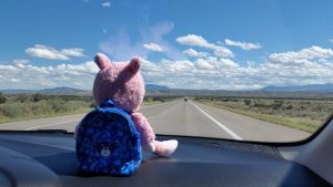
Our destination was the small town of Capitan, hometown of a one Smokey Bear! On our way there we passed through an area that reminded both SB and I of Iceland, which was weird considering that we were about 4,100 miles from it at that point.
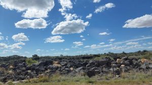
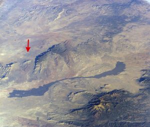
I mean, Iceland with sunshine, of course. Turns out that the area was called the “Valley of Fires” and is a a giant lava flow area (which is basically all of Iceland). Here is a high altitude photo of the flow, with the Trinity Site marked below the red arrow for localization purposes – the big black streak in the middle of the photo is the lava flow.
After we’d passed the lava flow and the town of Carrizozo (followed by many repetitions of “Carrizozo” is it is quite fun to say, is it not?) things started getting much greener.
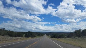
We soon worked our way back up into the mountains (albeit much greener mountains this time) and onward to Capitan, which sits at 6,348′ above sea level (for comparison the Trinity Site is at 4,921′). There we were headed for the Smokey Bear Historical Park, a small museum and memorial garden devoted to Smokey Bear! Now, if you’re from the U.S. you know about Smokey Bear, I am willing to bet money on it.

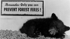
With his “Only you can prevent forest fires” motto (later changed to “wild fires” as we learned more about the role of fire in ecology) Smokey Bear has been a guardian of the forests against human carelessness since 1944, where he first appeared in the following poster:
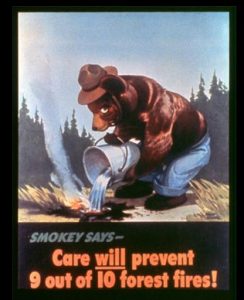
Now, what you might not know is that his name is not Smokey THE Bear, the “the” was only added in 1952 in order to make the name rhyme better in a song by Eddy Arnold. The wild popularity of the song at the time (you can listen to Arnold’s version here – though the song also proved so popular that it was covered multiple times, including covers by Peter Pan Records and Gene Autry – click those links if you’d like to hear their versions) had the effect of not only making Smokey way more popular, it also made people think his name was “Smokey the Bear” rather than just “Smokey Bear” – much to the chagrin of the Forest Service, who ultimately decided that it was probably better to focus on the now-popular message rather than the name.
Second, did you know that Smokey Bear was a real bear? To be precise Smokey Bear was the name given to two bears, both of which came from New Mexico. The first Smokey Bear was rescued by firefighters after being discovered in the aftermath of the 1950 Capitan Gap fire which burned through the Capitan Mountains around Captain. When he was discovered, the black bear cub was badly burned and clinging to a tree. The rescue crew originally named him “Hotfoot Teddy” (for obvious reasons) though he was subsequently renamed as “Smokey Bear” as he was a perfect “living symbol” for the promotional Smokey Bear which had existed since 1944 (six years prior to the cub’s rescue). Fortunately for Smokey he received good care, first in Capitan, then in Santa Fe, and shortly thereafter he was flown (still a big deal back then) to Washington D.C. to live in the National Zoo.
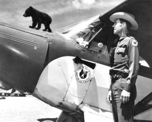
Smokey the Bear with the Piper PA-12 that would fly him across the country. Pictured as well is Ray Bell, the Game Warden who initially helped nurse Smokey back to health!
Even on his arrival Smokey was popular, with hundreds of people showing up to see him, and eventually he became so popular that he was receiving over 13,000 letters a week and the Post Office had to create a zip-code just for Smokey (20252, for reference) – meaning that Smokey Bear is one of only two individuals in history to have their own zip-code (the other being the President). Take that Santa Claus. Smokey Bear would go on to live in the National Zoo for 26 years. There he would come to love peanut butter sandwiches, bluefish, trout, and honey and berries – all while entertaining several millions of visitors over the course of his life. He would also be paired with “Goldie Bear” another rescued black bear. The Forest Service hoped that they would have some baby Smokeys to carry on the title, but they decided they didn’t want any children (Taco understands, Smokey, Taco understands).
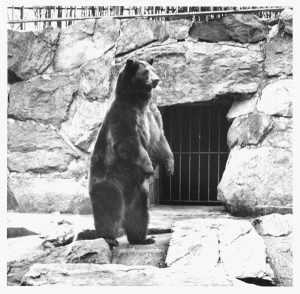
Smokey in his National Zoo enclosure.
Smokey Bear died of old age on November 9, 1976. The government then decided that it was best to return Smokey’s remains to his Capitan, NM home (interesting story about that here) and the spot where they laid him to rest would later become the Smokey Bear Historical site. After Smokey Bear’s earlier retirement on May 2, 1975, another black bear cub which had been rescued from the Lincoln Forest (also in NM) took on the mantle of “Smokey Bear” and became “Smokey II” or “Smokey Jr.” or “Little Smokey” – depending on who you asked.
“Smokey II” went on to fulfill the role of the living symbol until his death on August 11, 1990. The Forest Service then opted not to “swear-in” a Smokey III and so as of yet the living symbol position is vacant, though Smokey Bear as an icon most certainly lives on (he even has Facebook).
Given the lasting popularity of Smokey Bear (it is the longest running public service campaign in U.S. history) it’s no surprise that Capitan has embraced the legacy of their most famous resident. Partially a wildfire awareness center, partially a museum for Smokey, partially a museum for firefighters, and partially a memorial garden for the real Smokey Bear (I) – the Smokey Bear Historical Park is one of the town’s ways of remembering Smokey (that and an annual Smokey Bear festival, plus other local establishments from cafes to hotels named after Smokey). So, SB and I were drawn in from the start and drove 80 miles “out of the way” to get to it (not really out of the way in my mind, but logistically it was I suppose). The park was highly worth it – not to mention the entry fee is a whopping 2 bucks, seriously, that’s it.
The inside exhibit area has a video about Smokey Bear (real and fictional) and fire management, as well as fire-related posters from all over the world in addition to lots of materials related to wildfires, and firefighting in general. It is of course also loaded with all sorts of Smokey Bear memorabilia and objects.
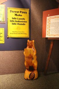
Valentino was oh so excited to visit and pay homage to a very famous bear – in truth Valentino was a big reason we went (much like Tristen and the Trinity Site – Pig was just cool with traveling in general).
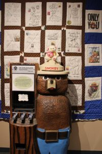
Valentino being the (literally) big-hearted Polar bear that he is was very interested in seeing Smokey Bear’s grave and to pay his respects.
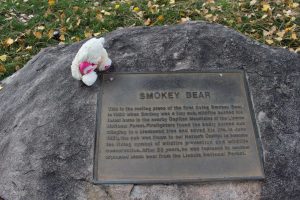
If you notice that small purple flower in the upper left next to Valentino, that’s the desert flower we found at ground zero. Valentino thought there was a certain symbolism to taking a flower from a site of great destruction and using it to celebrate the life of a soul which was so very against destruction. I tend to agree with him.
The grave itself was very nice and was within the larger garden area.
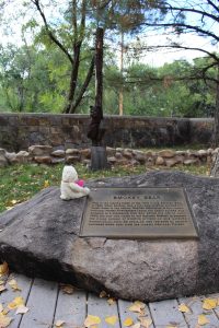
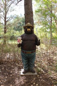
The garden was very well kept (even in October) and was full of all sorts of native New Mexican fauna (we saw a snake! 😀 ), as well as signs which explained what everything was. The garden was also the final “resting site” of the first “Friends of Smokey Bear Balloon,” which flew in the Albuquerque International Balloon Fiesta (among other places) before before being damaged in 2004 and later replaced by a new balloon. The garden, unsurprisingly, also has more information about Smokey and black bears in general – including a very happy Smokey Bear statute that Valentino was a fan of.
After walking through the garden we stopped back inside to get a Smokey Bear magnet (which SB and I accidentally left on the side of Felicia for a bit but it was a tough magnet and stayed on!) and then began the journey home as we were about 3.5 hours away per Google.
“Conclusion”
We had been told that the mountainous area around Ruidoso was very nice by our car salesman, and having driven through that area (on the way to and from Capitan) we have to agree! Once we were back down in the desert valley we came across a HUGE dust devil. I tried to hard to capture it, but my old phone’s camera was not up to the task of doing so between the motion, the distance, and the window glare. However, if you look closely in the following photo you can sort of see it to the left of the windmill.
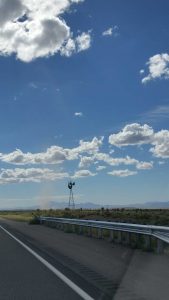
Here is a side shot of it, but again my camera couldn’t really capture it and by the time I got out our good camera it was too far behind us.
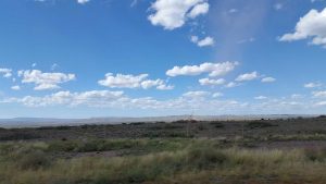
Earlier I mentioned the lack of wind at the Trinity Site but how it later picked up – the dust devil was a sign of the wind picking up, and as we headed south the entire horizon was covered in dust/sand storms.
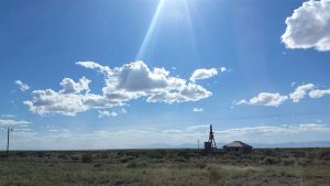
Again, hard to see in the photo, but look at the horizon on the left versus on the right.
Fortunately we never got into any sand storm (aside from a brief quarter mile or so) and most of our drive back was wonderful from a weather standpoint, though SB and I were quite tired at that point (the Boys, of course, were not – or at least claimed not to be 😛 ).
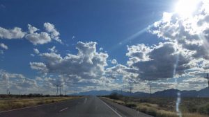
Tristen must have taken one of his trademark power naps as he got pretty rambunctious the closer we got to home (or maybe it was the radiation?).
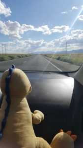
Once we did get home Alfred was there to great us, what a lovely neighbor!
We then gave Tristen his surprise coin from the Trinity Site. Tristen collects the special National Parks Coins (and some other sites) – but only select ones which meet his “manliness” thresholds and requirements – not just any coin is worthy of Tristen’s acquisition (so if you ever wanted to buy Tristen a coin, you probably need to verify with us that it’s manly enough first).

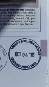
For SB and I’s part, we didn’t get a coin but we did get a Smokey Bear magnet (our version of coin, in a way) and also that glorious NPS Park Stamp. That sweet, sweet, rare Trinity Site stamp.
And that, dear readers, was the conclusion of SB and I’s first (official-business-free) New Mexico road trip. It was a lot of miles in a short period, and a long day considering we started at 4:30am, but it was a big day in a good way. I can’t think of the last time I started my day off with a military convoy, then stood in a nuclear blast zone, and then got to meet the world’s most famous bear all in the course of 12 hours or so. More importantly, I was glad that I was able to share the adventure with SB, the Boys, and now Felicia!
I hope you’ve enjoyed following along as well. And remember:
“Only you can prevent nuclear explosions!”
Until next time,
-Taco
