Dinosaur Bear Presents:
North to Alaska Part 1 of 4:
They go north, the rush is on
[Preamble: This is going to be a four part series on my recent trip to Alaska. Due to time constraints (law school + research assistant position) I’m going to focus on general highlights in these posts and not an all-encompassing trip journal. We have many, many photos and also some trip notes, but that isn’t the point of these forthcoming posts. Instead, I just want to share a bit of our adventure. After my last trip to Alaska I made a photo slideshow which more wholly chronicled the trip and seemed to have been well-received, I may or may not do that again (it’s surprisingly time consuming), but for now, enjoy this series of brief-for-me posts. Where applicable, I will provide external links so you access some more in-depth reading about something that you might find interesting. Also, if you have no knowledge of classic hit country songs, then you might not fully enjoy my post titles, as such, I highly recommend you click this link. I’ll be referencing that song more than once, as it was, understandably, the theme song of our entire trip. 🙂 ]
Greetings and welcome to my recollections of a recent trip to Alaska. I’ve designed this as a four part series and this part, Part 1, will focus on the “Road Trip” portion of our adventure – a road trip which ended up clocking in at over 2,600 miles. All said, we drove from Seattle, WA to Fairbanks, AK in 7 days with lots of little side ventures thrown in for good measure. Now, it must be said, that this isn’t something that you just do – no, a lot of planning went into this trip. Of course, when the alternative: not planning, might leave you stranded with not so much as a one-horse town (of which there is at least one left) 150 miles in either direction, then it becomes easier to do your due diligence. As such, we had a general plan even prior to our departure that included “what-if” scenarios (both the good and the bad – though thankfully we stayed in “good” territory the entire time).
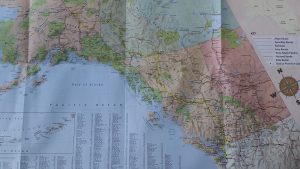
In writing this blog post I attempted to make a “map” of our route, but it proved difficult to do effectively due to the sheer geographic size of the trip. So, I’m just going to post this image. It’s not perfect, and you’ll have to enlarge it and maybe squint, but if you look closely you’ll see a highlighted path which shows the route we ended up taking. If it wasn’t obvious, we were headed north.
Here I’ll have to note that what that map (taken from the imminently useful ” The Milepost” book) labels as a “Major Route” does not mean that it is a well cared for road. Heh. Uh, no, not at all. In fact, what I’ve learned is that a “Major Route” in such areas as the Yukon might refer to a dirt road that has been a least partially maintained at some point in the past year. In other words, don’t hop in your sedan and expect smooth driving.
For those of you who are well versed in the art of driving north to Alaska (and who knows, maybe some of you are?) you’ll notice that we largely avoided the traditional and well-trodden ALCAN route. You can rest assured that this was entirely intentional, I elected to send us down long and dusty roads to nearly nowhere at most opportunities. 😉
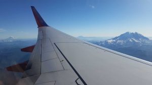
Anyways, in order to start our trip we had to get to Seattle. In a wonderfully ironic turn of events, it was raining in Boston as well as Austin, TX (layover) but there were completely blue skies in Seattle. In fact, not only could we see Mt. Rainer up close to the plane, we could see Mt. Hood way off in the distance (it’s a tiny little shadow to the far left in the photo below – just to the right of the larger mountain with snow. Mt. Rainer is the huge one on the right side of the photo).
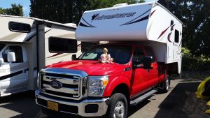
After a night at rather, ehm, “Side O Sea” Travelodge, the next day we picked up our transportation/house, Beckett! A 2015 Ford F-350 XLT.
After acquiring Beckett we headed north to Alaska, first dealing with crazy Seattle traffic and then going through some fortunately very easy customs at the Aldergrove border crossing. We picked up some groceries (also in Aldergrove) from a Safeway, and then were on the road – Canada 1 (the Trans-Canada Highway) to be exact!
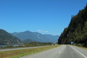
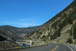
After a brief period of teaching myself not to look at miles, but rather kilometers, we settled into the drive for the day. Our first town was a place in British Columbia called “Hope” and they had a cool “Experience Hope” sign. I can’t say much about Hope as we didn’t stop there and instead continued on to Highway 97, but it’s at least a positive town name. We also passed through a town called “Boston Bar” (which we found humorous) and also a place called “Yale” (but no Harvard, disappointingly). While we didn’t know what to expect in southern BC, the scenery was pretty spectacular from the start.
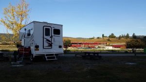
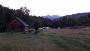
This was a bit of a “late start” day for us since we had to wait until 11am to pickup Beckett, then had to cross the border, go shopping, etc. But we still managed to make it quite a ways, passing through all of 70 Mile House, 93 Mile House, 100 Mile House, and 150 Mile House. All of which named for their respective distance along the Old Cariboo Wagon Road during the Cariboo Gold Rush of 1861. After nearly deciding to stay the night at Cache Creek we ended up pressing on, driving along the lengthy Lac La Hache (a lake), before finally stopping in Williams Lake for the evening. Our campsite was actually on the grounds of the “Williams Lake Stampede” a hugely popular rodeo held annually in Williams Lake, and after a bit of confused driving around the dark fairgrounds we finally found our way to the camping spots (the campground was closed since we were so late, but you could pay the next day). In case you were wondering, no, we had made no reservations. Due to how late in the season we were, we never had difficulty finding a place to stay.
The next morning we were up and around early for our first full day of driving.
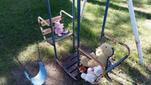
During our travels that day we passed through areas and towns such as McLeese Lake and Quesnel. Near McLeese lake we stopped at the “Cariboo Wood Shop” where we got a latte and some cappuccino fudge while the boys played on a swing.
Quesnel (pronounced “Kwa-nell” – not “Kwez-nal” as SB and I learned) was definitely a logging town, and they had the most massive lumberyard I’ve ever seen in my life. From there we continued through Prince George and onto Highway 16, passing through Fraser Lake on our way west.
Despite its scenic beauty, Highway 16 is locally known as the “Highway of Tears” due to a long series of disappearances and murders that have occurred along it since 1969. We saw several signs along the highway about the victims. Coincidentally, we also saw a black bear that had just been hit by a semi truck on this road (the semi was just up the road and the driver was attempting to bend the fender off the tire). It was still alive as we passed by, it wasn’t absolutely mangled or anything, but it was still an unfortunate scene.
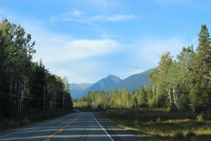
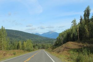
We continued along 16 for a good while (and noticed that other cars were becoming more and more uncommon), passing through Burns Lake – which was a gorgeous area – and Houston (not TX) complete with its 60′ fly-fishing pole. Eventually we made it to the start of the Stewart-Cassiar Highway which is generally just known as “The Cassiar” where we settled down at the “Cassiar RV Park” in Kitwanga for the evening.
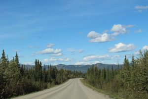
After some tacos and story-time (courtesy of a hoot-owl outside Beckett) we got some sleep. The next day we started north on the Cassiar, which was in deceptively good shape at first (strongly stressing the words “at first” here). We soon came to know the peril of “frost heaves” (or as Tristen came to call them, “Baby Mountains”) and while there were sometimes warning signs, there frequently were none.
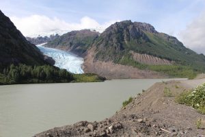
Our first stop of the morning was in Gitanyow for gas and also to check out their Totem Poles. After that we were back on the road, and after still more driving we made our first side trip over to Stewart, BC and Hyder, AK (remember Southeast Alaska actually extends nearly halfway down the west coast of British Columbia). Along the way we stopped at our first glacier, Bear Glacier!
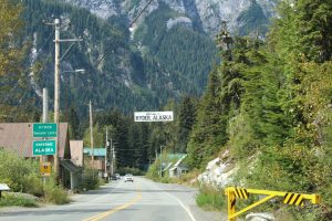
Like many glaciers, Bear Glacier is shrinking due to climate change (and it fact used to cover the entire valley shown above), but it was still a really gorgeous (and windy!) stop. From there it was on through Stewart to Hyder. The U.S. has maintained no border station here since the 1950s though Canada still has one when you are returning to Stewart.
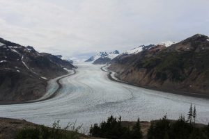
Hyder was uh.. quite the metropolis. That said, Hyder wasn’t really our destination, we were headed for Salmon Glacier (between Bear Glacier and Salmon Glacier Valentino was quite excited). Of course getting to Salmon Glacier is half the battle, as you have to use an old dirt mining road to climb to the top, but it was so worth it.
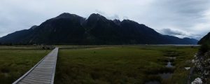
After spending some time at the glacier we headed down to the Fish Creek Wildlife Observation Site where we were going to try to see a bear (they frequent the area), but the Forest Service employee told us that we were still a bit early in the day for bear, so we headed back across the border (through border patrol this time) and hung out in Stewart for awhile – mostly to get some gas (Hyder appeared to have no station) and to walk around the boardwalks in the bay area.
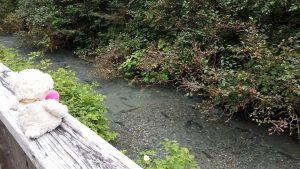
After a bit we headed across the border again to Fish Creek, and while we didn’t get to see any bears, we did get to see THOUSANDS of salmon coming up the creek to spawn, it was way cool. The photo below with Valentino is actually on a smaller side creek, but you can still see the salmon.
But, despite arriving right around the usual dinner time and it being the peak of salmon spawning season, we didn’t see any bears, yet. So we drove back through Hyder and crossed the border again again (this time assuring the border agent that it was for the last time) and then we progressed back towards the Cassiar.
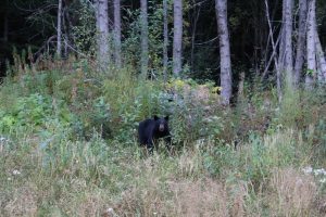
However, we hadn’t been on 37A (the highway that connects Stewart/Hyder to the Cassiar, itself 37) long when what to our wondering eyes did appear, but two black bears eating flowers!
In fact, as we progressed along our journey that evening we ended up seeing 9 bears in total!
That night we made it to the Bell 2 Lodge before stopping, which is aptly named since it is in Bell 2 (and yes there is a Bell 1 in case you were wondering).
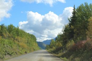
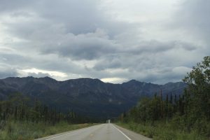
The next morning we were up and back out onto the Cassiar, which isn’t saying much since it’s really the only road in existence out there. As you can see, it had changed its appearance quite a bit since we had first started.
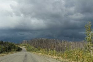
As we made our way northward we spotted another bear (bringing the count for this road to 10) before stopping for gas and lunch at a place called the “Tin Rooster” in Dease Lake. We also passed through Jade City, and while we didn’t stop we did see them carving some large chunks of Jade as we passed through. As we got closer to the Yukon we moved into some rather substantial storms, which when coupled with the fact that we met them in the middle of a large area of old forest fire damage made them even more ominous.
Fortunately we made it through the storm and by the time we reached the end of the Cassiar it was only raining lightly. From there we turned left onto the famous Alaska Highway (officially formerly, but still really, known as the ALCAN). Once on the ALCAN we stopped at Nugget City for some gas before getting back out onto the road.
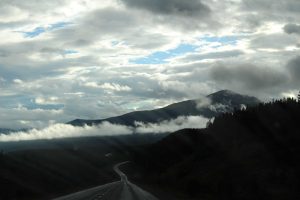
From there the road eventually passes back into British Columbia for a bit, taking you by places such as Swan Lake before crossing back into the Yukon. Eventually the storms caught up to us, or rather, we drove into the next line of storms, and this time around they were pretty intense. It was a definitely in the “torrential downpour” category and the wind was pretty crazy – Beckett was not amused. It stayed like that for quite some time before eventually calming down and yielding wonderful views.
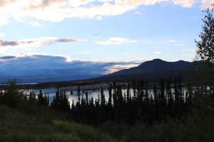
We kept trucking until we made it to Teslin, where we stopped at the Lakeshore RV Park for the night. This next photo was taken from across the Teslin River looking northwest towards Teslin town.
The bridge you see in that photo is the Nisutlin Bay Bridge, which is the longest water crossing on the entire ALCAN. Up where we took that photo was a little information gazebo where people had left their names, drawings, etc., so we added our own names to the long list of past (and future) travelers to Teslin.
After an especially cold night and morning (our sewage cap got stuck) we hit the road to continue west along the ALCAN and even crossed the Yukon River for the first (of many) times! “They crossed the Yukon River And found the Bonanza Gold.” Eventually we made our way to Whitehorse, which is the capital of the Yukon Territory. From there, we parted ways with the ALCAN and instead headed straight north onto Yukon Highway 2: the Klondike Highway (which is itself part of the Klondike Loop). If that sounds familiar to you, it should. That’s because the modern road retraces the general route of the northbound prospectors during the Klondike Gold Rush.
Of course the thing about the Klondike is that it is er.. well.. the Klondike. So, there isn’t much in the way of civilization outside of a few dedicated pockets. As such, we stopped and ate lunch in Beckett at the Fox Lake Burn Rest Area, which had all sorts of information about the 1998 forest fire that had ravaged the area (and was started by some idiot who didn’t put out their campfire). One interesting thing was that there was a clearly discernible layer of ash all throughout the area. At first I figured it was from the fire, but the ash continued well past the fire damage zone. Turns out it’s actually volcanic ash which dates to a ~700 AD eruption of a volcano in east Alaska that sent a cloud of ash all over the region, including well into the Yukon. Believe it or not, the great north has a good bit of volcanic activity, something I don’t remember learning about.
As we clambered northward we passed through a variety of neat little places, an especially noteworthy one was Carmacks, which was named after George Carmack who (along with his brother-in-law Keish) made the “Discovery Claim” on, and named the (in)famous Bonanza Creek which started the Klondike Gold Rush.
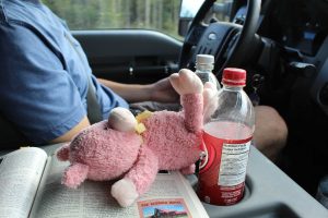
Of course in addition to learning lots of little historical tidbits (largely courtesy of The Milepost) most of the Yukon, let alone the Klondike, is just vast wilderness with little in the way of traffic or towns. So, for most of this portion of the trip the boys had to keep themselves occupied.
They didn’t struggle.
Eventually – after extended battles with dust and “Baby Mountains” – we made our way to Dawson City, the once beating heart of the Klondike Gold Rush now turned sleepy mining town of circa 1,300 people. We stayed at the Dawson City RV Park that evening and read up on some things to do in town.
The next morning we headed into “downtown” Dawson City where we had breakfast at a place called Cheechakos.
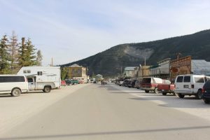
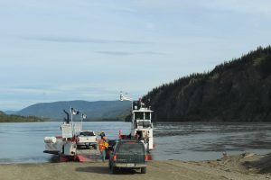
I didn’t understand the name at the time, but it turns out that a “Cheechako” was a newcomer to a mining region in Alaska or northwest Canada, whereas a “Sourdough” was an experienced veteran. We saw the term sourdough frequently (not realizing it wasn’t referring to the bread for quite some time – though the bread is a part of the etymology) but Cheechako not as much. We then wondered around main street for a bit (which is right up against the Yukon River) and also checked out the SS Keno Historic Site before driving (literally) just up the street to the George Black Ferry.
As you can see, this is not a very large ferry, and in fact it only operates seasonally until the ice prevents passage. It’s actually the last ferry left on the Klondike loop as the other crossings are now bridges, and despite attempts to build a bridge the residents of Dawson City do not want one as it would “open” them up too much to the world, I can’t say I blame them. Either way, we all enjoyed our ferry trip as we literally crossed the Yukon River.
Once across the river the road began to gain a lot of elevation quite quickly as we climbed up a long, long hill. Of course this makes sense since we were climbing up to the Top of the World Highway. Top of the World Highway doesn’t actually get its name from the fact that it is way up north, but instead it comes from the fact that most of the road runs along a ridge-line which gives you “top of the world” views.
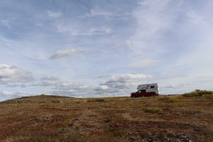
The “top” of the Top of the World Highway is just a bit east of the U.S./Canadian border and is marked by a plateau of stone cairns (I made one for us – one stone for each traveler) as well as a rock pile at the actual “top.” The “top” of the top can be seen on the left side of the photo below.
And yes, you can rest assured that I did climb up there. It’s hard to see in that photo, but it’s a decent bit above Beckett and the whole place was quite windy. After that it wasn’t far to the border as you can actually see the station from the “top.”
As we approached I was pleased to see that the road turned back into pavement, but that was just filthy U.S. lies – more on that in a second.
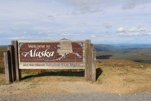
After passing through the border – which thankfully was nice and easy, even if the agent wasn’t especially friendly – we headed just a short clip down the road and stopped at the Alaska sign for a photo op!
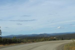
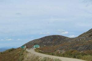
From there we passed through Boundary (which appeared to be little more than an old dirt airstrip and a few buildings) and continued along the Top of the World Highway until it met up with the Taylor Highway. Now, this stretch of road – which was really only paved near the border station – was a double-edged sword. On one hand, it was way out in remote Alaska and “the grid” wasn’t really a thing here. Plus, as we traveled along the road we saw a lot of prospectors actively working and panning in the creeks.
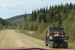
On the other hand, this was the most GOD AWFUL stretch of the entire trip as far as road conditions go. Not only was the road itself in bad shape, there were frequently cliff faces right at the edge of the road and since there was a soft (read: nonexistent) shoulder, there was no more than 12” between the edge of the road and a plummet to certain death. Additionally, there were potholes that looked like Beckett might even get consumed in them. So, there was quite a bit of white knuckle driving for what felt like hours as we navigated down and up, and down and up again this winding stretch of road while attempting to avoid the cliffs and also make it through U-turns that gave new meaning to the letter U.
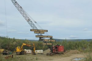
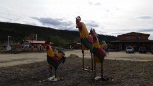
Fortunately we made it through with no issue, and our reward was the AWESOME town of Chicken, yes, Chicken, Alaska (they even have a website).
Chicken was actually a big reason we took this route, as Tristen wanted to eat some ricken’ in Chicken, and also ride the chickens, which he did.
While in Chicken we had lunch (chicken of course), panned for gold and found gold dust (and by dust I mean molecules), found a magic rock for Pigsten, crossed a suspension bridge, and when we were heading out we saw our first moose!
The good news was that the super friendly folks of Chicken, all.. like.. 7 of them told us that the road on the “south side” of town was much better than the area we had come from. Turns out they were right, and other than some intermittent destroyed sections the Taylor Highway was almost like a real road from there on out!
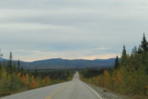
From there we actually headed south for a while in order to reconnect with the ALCAN and complete the Klondike Loop. Once back out on the ALCAN we stopped in Tok (pronounced “Toke” not “Tock” as SB and I also learned) for some gas and from there it was largely good roads with amazing scenery as we trudged northwest towards Fairbanks.
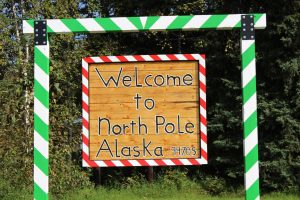
Between Tok and Delta Junction we saw our second moose, and a ways after that we saw a fighter jet doing some crazy acrobatics in the sky, which clued us into the fact that we were approaching Eielson Air Force Base long before we saw the base itself. As Eielson is only around 26 miles southeast of Fairbanks that meant we were getting pretty close, but Fairbanks wasn’t the goal just yet. Nope, we were bound for North Pole! While we looked around the town a bit when we arrived, we mainly just head to base-camp for the evening at the North Pole Riverview RV Park, so named for the fact that it sets next to the Chena River (pronounced “Chin-a” not “Chee-nah” as SB and I also also learned, notice the pattern?), which flows through the middle of Fairbanks.
The next morning we got out and explored North Pole itself!
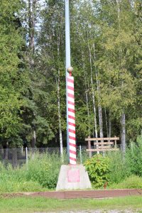
In addition to seeing the Visitor’s Center we also saw Santa’s House, Santa’s sleigh, Santa’s reindeer, Santa himself, and picked up some yummy red velvet fudge and a latte made by one of Santa’s slaves. Tristen was quite pleased with Santa’s operation. We also saw the twin to the real North Pole Pole at the 5th Avenue Park (across from a duck pond, yay!).
Confused by what I mean? Here is the text from the plaque at the base of the pole:
“‘The North Pole’ – This pole is one of two poles manufactured in 1951 as part of a campaign to properly mark the top of the earth. After a grand tour of the United States, its twin was pushed out of the tail hatch of an Alaska Airlines DC-4 over the geographic North Pole on the arctic night of December 11th. After being rediscovered in 1972 (in an old junkyard), this pole has been prominently displayed in its current location since the dedication of the park on July 4th, 1976, by the North Pole Jaycees”
[Author’s note: I did some fact checking and all of this seems to check out despite being an oddly unknown story in modern times. Also interesting, the DC-4 which took the pole north was dubbed the “Polar Express.”]
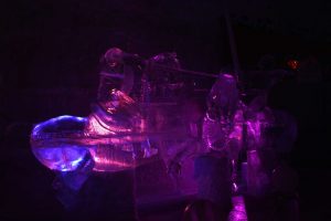
After that we got some breakfast/lunch at the Country Café (including an omelet with reindeer sausage) and then headed northwest towards Chena Hot Springs. Once at the hot springs (about 62 miles northwest of Fairbanks) we got a “rustic” campsite in the back 40 near Monument Creek which turned out to be really nice since I backed Beckett in so we could listen to the creek running about 15’ behind us. We then settled in for a relaxing evening as the hot springs were kind of our “reward” for making it to the near-end of our long road voyage. In addition to spending a good chunk of the evening in the hot springs themselves (duh) we also got to see a huge ice museum where (other than stuff like electrical wires) literally everything was made of ice. I was particularly fond of the “Joust” sculpture.
It was, of course, freezing in there so we had to bundle up and wear provided parkas, but it was well worth it prior to hitting up the hot springs.
That night I woke up around 1am and finally managed to see the Northern Lights. Now, I must say that I only saw like the gimp version of them and not the crazy magnificent version of them you see in photos. However, after being denied like 3 nights in a row due to clouds it was nice to at least see a baby-itty-bitty version of the Northern Lights. It would have been nice if it would have been an active night, as opposed to a largely inactive night, but I’m not complaining, at least I got to see them – plus I got to see a night so completely cloudless and unaltered and so full of stars and a gigantic moon that that alone was worth it. I don’t think you’ve seen the night sky until you’ve seen in it in such an isolated place.
The next day we got up and around and headed the 62 miles back into Fairbanks where we gave Beckett a bath and a camper cleaning and then brought him to his home. It was oddly sad to leave him (kind of like Lillian) but since Beckett actually lives in Fairbanks (and was just traveling to Seattle) I’m sure he was happy to be home. Once Beckett was dropped off we took all our stuff out to a picnic table and waited on the taxi – thus ending the road trip portion of our adventure.
As crazy as it sounds, we weren’t even halfway done with our voyage yet, and despite having went as far north as Chena Hot Springs we were going to much, much further north than that. But that’s a story for Part 2. 🙂
Until then,
-Taco
Well” I”m jealous…….sounds like a good time was had.. Aaaaaaaahhhh the great out doors[new meaning]
Definitely a new meaning! 🙂
I am jealous too! Looks like a fantastic time!
Can you clarify about the “baby mountains”? Were they potholes?
And the Highway of Tears made me 🙁 I had to google it to learn more.
They were Frost heaves.
Ah, I see.
Yay, Alaska adventure! One of the benefits of being so behind on reading your blog is getting to relive this amazing trip.
Also, I love how Chicken, Alaska has its own website.
Yay! Chicken was a cool place. 🙂