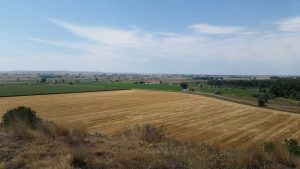
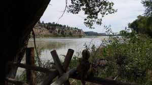
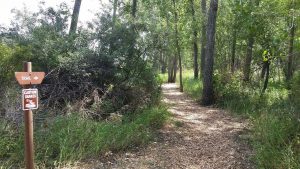
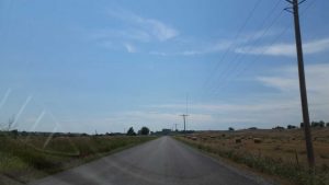
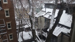
Greetings from Montana,*
Welp, here we are, the final check-in. Like Colorado and New Mexico before it, my time in Montana has come to an end. I think this summer went by much quicker than last summer, and that isn’t entirely retrospective, I’ve felt like that for awhile now.
But, life moves fast, so let’s get started – as a usual I have a lot to discuss including a lot about myself and a lot of history, but I’ll leave it up to you to decide which I prefer talking about. 😛
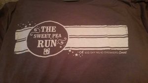
When we last left off SB was back home (I’d actually got to see her plane fly by when I was at work) and I was moving into the final stretch of both work and my time in Montana. However, in typical Taco fashion I wasn’t walking to the finishing line, I was running – and I mean that both literally and figuratively. See, in the tradition of the Big Gay 5k I’d decided to run another race, but this time I was going to step up to a 10k – the longest distance I’ve ever run (roughly 6.3 miles). This was also the first run that I would be doing that included both street and trail portions. Further, of the 6.3 miles about 2 of them were uphill and this at somewhere between 4,820 and 5,000 feet above sea level. I was originally going to do a 10k up around Three Forks, but in a classic case of bad customer service, they failed to respond to my questions at all and so I decided that if they couldn’t do me the service of answering an email then I didn’t feel like supporting their cause. So I switched over to the 10k associated with the Sweet Pea Festival in Bozeman and had no regrets. The Sweet Pea, in addition to being a musical and cultural festival also hosts two simultaneous races, a 5k and a 10k, both of which are actually put on by the Big Sky Wind Drinkers – a running club with one of the most awesome names for such a club I’ve seen – but hosted within the larger Sweet Pea festivities.
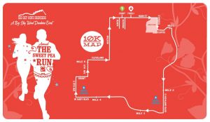
The 10k started at 7:15am on 8/6, while the 5k started at 7:25am. While this route map will mean absolutely nothing to you if you aren’t familiar with Bozeman, I’m posting it here for posterity.
So, when the race starts at 7:15am and I live about 10 miles away that means that my tradition of sleeping in on Saturday wasn’t going to extend into my last weekend, and thus Tristen and I got up around 5:30am.
We then got around and did some light floor exercises to get ourselves woke up (since I didn’t want to drink coffee prior to the race and thus shit myself on mile 4) and then headed into town. I was concerned about parking, since parking near main street in Bozeman can be tricky on a good day. However parking turned out to be a non-issue and thus we were a little early.
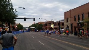
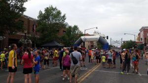
This gave me time to walk around a little bit and get my legs ready to go. There were 347 people in the 10k (and 799 in the 5k) so things were starting to get fairly busy on main street.
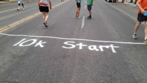
I ended up cutting it pretty close on the start time because the lines at the porta-pottys were moving stupidly slow. So I had to run to the start line to make it in time to actually start the race, which I found ironic. I of course have no photos from the race itself, but I will say that on the whole I impressed myself. For one, I found out that I seem to be a strong uphill runner. I’ve noticed in the races I’ve done that I tend to do quite well uphill and not so well downhill – interesting I know. But this allowed for me to pass a sizeable chunk of people on each hill, and more importantly, it allowed me to move faster – rather than slower – as we progressed deeper into the race, where a few late hills caused me much less problems than I anticipated. Second, as you can see from the photos it was overcast. This was a blessing because it had been very hot recently and while it was still hot, it wasn’t anywhere as hot as it would have been if the sun was blazing down on us. So, I did well, and while the stretch between miles 3 and 4 was pretty miserable, on the whole my first 10k was much more manageable for me than I think my first 5k was.
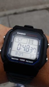
My final time was 48:37, which calculates out to about a 7:49 pace. While that isn’t going to win any awards, I was extremely pleased as my goal was to come in under 1 hour, and since I beat that time by 11 minutes and 23 seconds I was quite happy.
The race also reminded me of how pathetically competitive some people can be. Now, as to not be one to ignore the plank in my own eye, I am competitive as well. However, the vast majority of my competitive nature is turned inwards, sometimes to an unhealthy point, but it’s what has gotten me to where I am in life (both the good and the bad). So, when I run in a race I am running against myself and only myself, and within the past six years my legs – really my legs are my mortal enemy in foot races (talk about irony). However, there are some people – probably the same people who nearly gave themselves aneurysms over inter-mural sports in high school – who sign up for “fun runs” such as 5ks and 10s and then view themselves as Olympians-to-be. These are the people who get visibly pissed off when you pass them and will even go so far as to cut you off – sometimes dangerously so – to prevent you from passing them. I could understand this a bit more if we were professional athletes in the final stretch of some world championship, but we’re not, we’re normal people running in what is essentially a charity race. Yet, time and time again, you get the douche bags. Normally I am pretty good at ignoring them, you just sort of accept that it’s going to happen and just keep on keepin’ on. However, during this race I had a woman, who we shall simply call “bitch,” nearly run me into the concrete edge of a bridge.
She was one of those people who you can just tell takes things way to seriously, if you run you will know exactly the kind of person I am talking about. Bitch was decked out in all sorts of top of the line gear which probably amounted to at least 400-500$ (for a running outfit). But it wasn’t just the clothes, it was her style. I saw her bumping into to people to get around them more than once, and she bumped into me when she came around me – which was entirely unnecessary when you’re not in a tight spot or blobbed up at the start of the race. Well, we eventually got to a sizeable hill and I started passing people left and right, and sure enough I came to bitch who suddenly wasn’t doing so well now that she wasn’t running downhill. I got up close to her and then we started going downhill towards a bridge crossing. My guess is that she was still winded because I came up on her fairly quickly. She then looked over her shoulder at me, saw I was there, and picked up her pace a bit. That’s pretty normal, lots of people don’t like being passed. But I was still gaining on her. Then, right before the bridge, she looked over her shoulder again, saw I was passing her and then literally lunged across the sidewalk to be directly in front of me, which in turn caused me to veer into a concrete barrier to avoid colliding with her. She then looked back again and kept running once she saw that I had slowed down. It was obviously intentional, there was no way she hadn’t intended for it to happen. Namely because she hadn’t just moved in front of me, she had lunged hurdle-style to cut me off.
So then the race consisted of Taco, Taco’s Legs, Bitch.
Now bitch gained a lot of ground after that, apparently spurred on by the act of being a bitch, she got a second wind and I even saw her cut off a couple more people – including a kid who couldn’t have been more than 12 (bitch was probably in her mid 30s). But Taco doesn’t forget – few sayings are more true – and so I bided my time for the next 2.5 miles or so, watching bitch from a distance, deciding how I was going to prove a point. The opportunity came in the last 3/4 of a mile of the race. This last portion of the race actually merged the 5k and 10k routes, so the 5k crowd (which was generally moving much slower) suddenly bunched up with the 10k crowd (who had been running for 2x as long). I personally thought it was poor route design choice, but it turned out to be really helpful in my bitch vengeance. The street that this merger occurred on was only half closed, meaning that the runners only had one “lane” to move in. This resulted in the 5k people hugging the right side, while the 10k people so of fluttered between the barricades and open pockets of 5k people (again, a bad design choice in my opinion). But then I realized that if bitch suddenly came upon an obstacle, that she’d then only have three choices – to stop, to slam into a barricade, or to get consumed in the crowd of 5k people pushing strollers. I decided to become that obstacle.
So I crept up on bitch which wasn’t hard due to the slight incline of the street. This time I passed her wide after I noticed her still cutting off people, or at least attempting to in the newfound crowd. I then moved in front of her and started slowing down. But me being me, I didn’t just do this in the open street, I did this at the precise point where the 5k crowd and the barricades formed a choke-point. I then causally turned around and looked directly at her, making sure she saw me, and then I slammed my feet down to a complete stop directly in front of her. I’m talking 7:49 mile to 0mph in less than one second. Since I had slowed to the point of being obnoxiously close to her, I heard her feet stumble and then she said something, I’m not sure what, but I can imagine, then she half stumbled into the 5k crowd. I then took off again, also making sure to look back at her. The end result was that bitch got stuck behind a group of people with strollers and went from being right next to me, to being a full 20 -30 seconds behind me. I quite enjoyed that. While I’d like to think that in the future she’ll think twice about purposefully cutting people off, my guess is that she won’t, but I like to imagine that she later raged about me to the few friends she probably has.
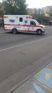
Another odd thing about “low-end” races is how hard some people push themselves. For instance, when I crossed the finish line there were a few places where people had obviously puked – seriously people? Then there is the inevitable person who tries to run a 5k despite never training for it and hurts themselves. I know it was a 5k person too because the 5k people had yellow bibs while the 10k people had blue, and the person loaded into the ambulance was yellow.
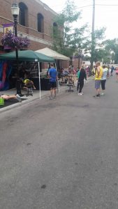
On the whole though it was a great race that I really enjoyed, plus since one of the businesses sponsoring the race was a physical therapy/sports medicine place there were tables set up for free post-race massages!
I didn’t stick around to get a massage, crazy I know, but I was really ready to get back home and eat a proper breakfast, as I am not a person who can eat much prior to running lest I end up puking like the aforementioned barf brigade. But even though I didn’t get a massage, I did add another race to my books and I am now officially a honorary Wind Drinker!
It really says a lot that six years ago I could barely walk on some days and now I’ve ran a 10k. Sure, my legs really tried to make me regret that decision and its not like I don’t have pain every step I take, nearly every day of my life, but in the story of Taco, I’ve impressed myself when it comes to not letting pain define me (as well as for not becoming addicted to the incredibly powerful pain killers I’ve been prescribed but seldom use, likely because they turn me into a hyper-aggressive dangerously angry asshole).
On the way home I stopped at the gas station to feed Moose III. I also had to give his right-rear tire some more air.
When SB and I were in Yellowstone Moose III had blasted some alarm about a tire going flat, which promptly freaked me out given that we were on our grand trip down to the Tetons the day it happened. Fortunately it turned out that Moose III likes to give massively preemptive warnings and our “flat tire” alarm was really an “unusual pressure” alarm. We stopped in Mammoth (luckily this happened near one of the few service stations in the entire park) and found out that they had free air, so I checked all four tires – not knowing which one it was. Well, the people at Hertz had 3 of the 4 tires running over 40 PSI, despite the tire saying not to run over 40 PSI right on the tire. So I dropped those down to the 36-38 range as recommended by the manual. I then noticed that the right-rear tire was running at about 34, so a good 8 pounds lower than its companions. I figured I’d found the culprit, so I aired it up to match its tire bros and then we were on our way. We had zero problems for the next bajillion miles, but then the night before SB left as we were pulling into my driveway the alarm went off again. So after my 10k I checked it (more free air – seems common out here), and while the other 3 tires were right where I left them, the right-rear had descended down to 31 PSI. So I aired it all the way up to 40 PSI because Tristen and I had a heck of a day-trip planned for the next day.
A day-trip which started like this.
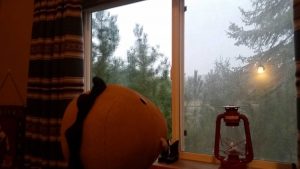
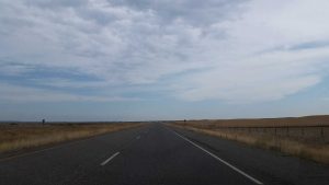
Yep, almost as if it was sad I was leaving, Montana had decided to flip over from clear blue skies to a series of torrential downpour days. Now, this was great news for the people fighting the forest fires, but not so great news for people wanting to explore. The good news was that the storms were mostly in the western portion of the state and my trip was going to take me to the eastern half of the state, a mythical place that I’d never been to before (except on a train that was much further north). So after our Sunday “manries” weight-lifting session Tristen and I got packed up for a day on the road. For Tristen this mostly meant packing his truck.
But we also had plenty of drinks and snacks – the goal was to spend no money on food.
Once all packed up we hit the not-so-dusty-but-instead-rainy trail.
Despite the earlier downpours we managed to sneak out in a period of relative calm.
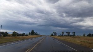
If you look closely you can see a bitties little plane.
Now, unfortunately this calm didn’t last, but this makes for a good time to mention where we were headed. We had two primary destinations for the day. The first of which was Pompeys Pillar, located a mere 180 miles from home (if you have no idea what that is then stick around for I shall explain it in great Taco detail momentarily), and then from there the second stop was the Little Bighorn Battlefield, which you are almost assuredly familiar with though you might know it better as “Custer’s Last Stand.” In total this would end up being a 450 mile road trip. Yep.
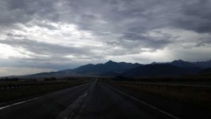
Now as for that weather, it stayed calm right until I got to the worst part of the pass through the Bridgers, naturally. So that was kind of fun and dangerous. Nothing like driving along a winding interstate as you barrel downwards through the mountains in the middle of the pouring rain with RV people who should never have been allowed to drive such a large vehicle in the first place. Tristen enjoyed it, of course.
Once we got to the other side of the mountains and were approaching Livingston things lightened up – it seemed like the worst of the storm was just sitting right on top of the mountain pass, figures.
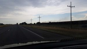
From there on out things were smooth with only some light rain from time to time and we even got to race a train!
After many miles of driving the mountainous terrain slowly transitioned into this:
..which I found oddly captivating in its own way, and still hugely preferable to a city.
Eventually we found our way to Pompeys Pillar National Monument.
And, as you probably guessed, it’s now time for History Lesson #1:
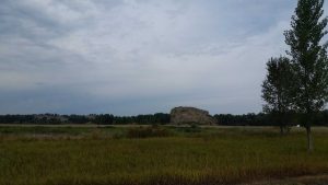
So just what is Pompeys Pillar? Well, this is Pompeys Pillar:
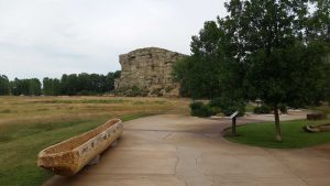
A giant 150′ tall sandstone pillar jutting up from the landscape near this portion of the Yellowstone River.
Ok, but what makes it important? Well Baby Jesus put it there. But more specifically, it’s home to the only remaining physical evidence of the Corps of Discovery Expedition – or as you probably known it – the Lewis and Clark Expedition. My guess is that you probably couldn’t tell me their first names to save your life (until recently I couldn’t either) but as a good bit of trivia knowledge they were Captain Meriwether Lewis and Second Lieutenant William Clark. Now, Lewis and Clark are hot shit in Montana, probably because they actually crossed through here. It’s not uncommon to see these signs all over the place:
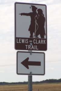
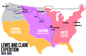
Now, if you’re like me then your knowledge of the Lewis and Clark Expedition is probably a little fuzzy, and might be mostly reduced to that semi-obscure grade-school musical “The Adventures of Lewis and Clark” – particularly the retort “CLARK and Lewis” which has been stuck in my brain for over two decades. According to this musical the pair were “doing their best for all of humankind,” I have this odd feeling that subsequent generations of Native Americans just might dispute this assertion – though in fairness to Lewis and Clark themselves they seem to have gotten along comparatively well with the tribes. Anyways, as a refresher – if not primer (keeping in mind that my school also taught me that winter was when earth is further away from the sun, which is not only wrong, it’s entirely the opposite of the truth) – here is a map of the Lewis and Clark Expedition.
If you study it for a moment you’ll realize something. Yep, for part of the voyage Lewis and Clark split up. Somehow I don’t ever recall learning that, but sure enough, the two (and their compatriots) split up in order to cover more territory, which was kind of the entire purpose of the trip in the first place. This brings us to a place now called Montana and even more specifically to a big rock now called Pompeys Pillar.
This rock has since become rock-famous because a one William Clark – whose detachment was at the time separated from his broski Lewis – but had the famous Sacagawea (of whom I have climbed a mountain named in her honor) with him. This is where the “Pompeys” portion of the Pompeys Pillar comes in. Pompey comes from “Little Pomp” which was the nickname given to Sacagawea’s infant son, Jean Baptiste Charbonneau, by William Clark. While we aren’t entirely sure why Clark decided to name the infant “Little Pomp” or “Pompy” (as his otherwise extensive notes don’t detail this) it is believed he got the name from a Shoshoni (Sacagawea’s people) word meaning “Leader” which when anglicized sounds similar to “Pomp.” So, Clark was most likely affectionately calling him “Little Leader.” Since Pomp was just three months old when he joined the expedition, it seems a fitting name in retrospect.
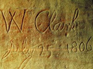
Now, as for this particular sandstone rock, that brings us to the afternoon of July 25, 1806. Clark and his detachment came across the huge rock and noticed that the local natives had carved their names and petrogylphs into the face of the rock – and appeared to have done so for quite some time. Clark then took it upon himself to add his own signature to the rock as well as climb to the top where he wrote:
“[A]t 4PM [I] arrived at the remarkable rock situated in an extensive bottom.This rock I ascended and from it’s top had a most extensive view in every direction. This rock which I shall call Pompy’s Tower is 200 feet high and 400 paces in secumpherance and only axcessible on one side which is from the N.E. the other parts of it being a perpendicular clift of lightish coloured gritty rock.The Indians have made 2 piles of stone on the top of this tower. The nativs have ingraved on the face of this rock the figures of animals.”
William Clark, July 25, 1806.
The result was a small piece of physical evidence – in fact the only piece of physical evidence left at all – of the entire Lewis and Clark expedition. Now, as to why the name changed from “Pompy’s Tower” to “Pompeys Pillar” (notice not only the change of spelling but also the lack of possession) of that I am not sure, other than that I know the name changed in 1814, so 8 years later.
So, now that you know why this particular rock is important, it’s time to recount Tristen and I’s visit. Since my guess is that you previously had no idea Pompeys Pillar existed, it will be no surprise to you that the site only gets around 50,000 visitors per year. That might seem like a lot, but in comparison to the megalopolis that is Yellowstone, this site is practically abandoned. That’s unfortunate in some ways, but good for people like Tristen and I who don’t like people but do like history.
As soon as we paid our dues and got into the area the sun started to come out, and oh lawds, it started to get hot. It was also oddly humid near the river itself, which is uncommon out here.
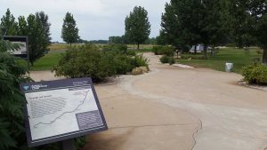
The area has a cool idea, in that you follow the informational signs along a recreated path of the Yellowstone river, with each sign corresponding to something the expedition encountered at that point and when possible they include quotations from the explorers journals. Way cool.
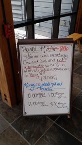
Inside the visitor’s center they have a whiteboard where each day they include a quote from that same day (except during one of the expedition’s two years, obviously). I thought that was a neat idea.
I particularly loved the way they spelled “misquetor.” If you’re from the Midwest then you’ll recognize this name for mosquito (or possibly the even shorter “skeeter”). I felt quite happy knowing that Lewis and Clark hated the little “misquetor” bastards as much as I do.
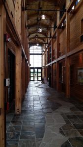
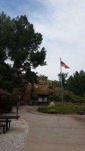
As you can see the Yellowstone Path “flowed” right through the visitor’s center, which was quite a nice building actually.
Once you come out the backside of the center you can see Pompeys Pillar as well as a few more exhibits, including recreations of their makeshift canoes.
From there it’s just a short walk to the base of the outcropping.
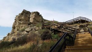
Despite the rapidly increasing temperature, it was a really nice day to be out there. Since obesity and lawyers (*cough*) now preclude people from climbing the rock like ole’ Clark did they’ve built a (surprisingly nice) series of stairs and walkways up to the top.
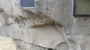
About halfway up it veers off to a side platform and here you can see a myriad of signatures and symbols – some of which date much further back than Clark’s.
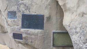
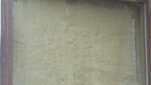
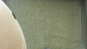
I’m not sure why they felt the need to embed plaques in the rock face but they did. Now, since people are mostly shit, you just know that some asshole would have come along in modern times and carved Clark’s name off the rock. So while I am normally against modifying things, they’ve long since placed Clark’s signature behind a glass case and put up a myriad of security cameras and proximity alarms. The good news is that the glass was clean and you still get really close.
And since my phone isn’t the best, here is a more professional shot of his signature.
So you can literally stand in the footsteps of William Clark. It’s the only location on the entire route where you can be assured that you are following in the footsteps of the United State’s most famous explorers.
Aside from Clark’s signature there are loads of other signatures, some just as old (or older), some much more recent – I found some as recent as the 1960s, but my guess is that since this was designated as a national historic landmark in 1965 that that put an end to the carving (it was re-designated as a national monument in 2001 – as to why, that has to do with federal regulations and really isn’t worth explaining, just know that if you carve your name in it now you’re gonna have a bad time).
Tristen, for his part, was surprisingly enamored by the signature. I wasn’t sure how interested he would be – as driving 180 miles to see name carved in a rock isn’t everyone’s forte – but he loved it. Probably because he loves “manries men of resteryear” and explorers in general, for example his favorite president is “Reddy Roosevelt.” So Tristen seemed to enjoy the signature just as much as I did.
If only William Clark knew that a dinosaur would be checking out his signature 210 years later, I can only imagine what he would say. 🙂
Since it wasn’t very crowded Tristen and I had the lower platform all to ourselves, ourselves and a rock pigeon that is.
Rock pigeon probably had a nest in that crevice because it was pissed and trying to act as threatening as is possible for a pigeon (read: not very). So I gave pigeon friend some peace and continued heading up the pillar, which quickly offered some good views.
While passing by that rock to the left (which had some awesome petroglyphs on it) I noticed a marmot buddy!
If his sneaky rodent nature has allowed him to elude you, then here is a closer shot:
Tristen tried to eat it, but I restrained him.
Once at the top of the pillar you come to another platform which unfortunately keeps you rather restricted (recall the obesity and lawyers) but you still get to see the same views that Clark and his companions saw, albeit with much more civilization this time around.
This is looking towards the Yellowstone River:
Here’s a wider angle of the same view, just looking more directly north:
And then here is the southern view, which I have this odd feeling has probably changed quite a bit more in the past 210 years than has the northern view:
There was a small tour group up at the top and they had a guide who seemed overly anxious to engage people in questions – so not wanting human interaction, we didn’t stay up there to for too long, plus it was getting balls hot up there. So Tristen and I descended down to the river where it was much cooler.
We decided to take one of the side trails back to Moose III – despite the snake warning.
Turns out that snakes weren’t a problem but the damn “misquetors” seemed hellbent on avenging the thousands of flies I’d slaughtered, and were constantly swarming me – though not Tristen, of course. Still, their relentless assault didn’t keep me from getting a couple of good shots of the river.
In the end I made it to Moose III without any actual bites (had I been in Zika ravaged Florida I’d probably have sprinted through those woods like a ninja on fire) but I was still ready to be out of the heat and misquetor hell. So Tristen and I had some lunch and busted out our Pepsi before hitting the road for our second destination. Now, as the crow flies Crow Agency (*ba dum tss*) is about 75 miles from Pompeys Pillar. However, the suggested routes involve either backtracking all the way to Billings (roughly 25 miles) and then heading south, or out to the junction of Interstate 94 and Highway 47 and then south (also roughly 25 miles). So both suggested routes add in – what I deemed to be – 25 unnecessary miles. Enter Taco, GPS defying crazy person (not really). I decided that I didn’t feel like going 25 miles out of my way, and instead that I’d just go straight south on some road called “Fly Creek Road” which had a sign half hanging off of wooden – yes wooden – posts and which was full of bullet holes and which didn’t show up on the map. AWW YISS back home again in Indiana.
It started positively enough.
I figured if there were train tracks then it couldn’t be that bad.
Eventually the pavement stopped, but there were still train tracks.
However, the tracks eventually stopped and not only that, I came to realize that 1) I hadn’t seen a single other car, and 2) I was quickly venturing into “The Hills Have Eyes” territory.
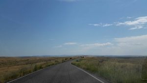
After awhile even the abandoned and decrepit buildings faded away and then it was just me and 10 trillion miles of plains.
Hell, even the hay-bales stopped after awhile.
Fly Creek Road seemed to stretch on for eternity and I just kept thinking about how that right-rear tie was ever so slowly deflating.
Fortunately those “10 trillion miles” only lasted a little over an hour in reality (and were really more like 41.3 miles – but hey 10 trillion, 41.3 close enough), and soon enough I was reconnected with civilization, or rather a road with people on it.
From there it was about another 33.4 miles to Crow Agency. Aside from some weird “wavey” portions of Interstate 90 – which felt like a roller coaster when met at 80mph – this last portion was a super easy and low-traffic drive. Soon enough we’d made it to the Little Bighorn Battlefield National Monument.
Although Little Bighorn was much more crowded than Pompeys Pillar, it still wasn’t anywhere near Yellowstone crowds – something I quite enjoyed.
So, my guess is that you are much more familiar with Little Bighorn than you were Pompeys Pillar (at least prior to this post, and at least until you forget everything I’ve wrote 15 minutes from now), but even if you think you know a lot about “Custer’s Last Stand” my guess is that you know much less than you think you do and that what you do know probably has a lot of inaccuracies in it, and lest you think I’m excluding myself from these accusations, I’m not, I learned that much of what I thought was true was not.
So, in order to allow you better appreciate the following photos, you first need to understand the Battle of the Little Bighorn a bit more than you might have learned in high school or from the History Ancient Aliens Channel. And thus begins History Lesson #2:
First, the Battle of the Little Bighorn was so called because it happened near the Little Bighorn River. Second, it wasn’t an isolated conflict, but was instead part of the Great Sioux War of 1876 (which was itself part of the larger Sioux Wars, themselves part of the even larger American Indian Wars) which was essentially a U.S. military campaign to purge several Native American tribes from their homelands (in this case the broad Black Hills region) because gold had been discovered there, but mostly because they weren’t us and we didn’t like that. Make no mistake, we were not the “good guys” in this conflict and by most accounts (with which I mostly agree) we were the villains. The Great Sioux War of 1876 was mostly comprised of the United States, the Shoshone, Crow, and Pawnee on one side, and the Lakota, Dakota, Cheyenne, and Arapaho on the other side. On the United States side of things you had President Ulysses S. Grant politically leading the charge into Indian territory, while the on-the-ground forces were headed by George Crook and George Armstrong Custer both of whom were distinguished veterans of the American Indian Wars and the American Civil Wars and were capable soldiers and leaders in their own right. On the opposing side, the Native forces were led by Sitting Bull (Hunkpapa Lakota), Crazy Horse (Oglala Lakota), and Gall (Hunkpapa Lakota). While all three were cultural icons for their respective tribes – and deeply respected throughout the wider tribal alliance – Sitting Bull was a holy man by nature, whereas Crazy Horse and Gall were warriors. The result was that when grouped together the three didn’t always see eye to eye, but they were extremely effective as leaders for the differences they brought to the table.
While George Crook played in his own part in history and is a worthwhile tale, our story focuses on George Armstrong Custer and his infamous final encounter on the hills above the Little Bighorn River on June 25th, 1876. Which brings me to my next point, when you think of the Battle of the Little Bighorn you probably imagine those famous (completely anachronistic) paintings of Custer and the 7th cavalry battling it out on Last Stand Hill. Well, that happened – though probably not like you think – but in reality the battle itself was much larger (spanning around 5 miles) and lasted two entire days. So Battle of the Little Bighorn wasn’t just Custer’s last stand, it was a two day engagement with ebbs and flows that lasted from June 25th to June 26th, 1876 and due to some confusion, really lasted until the 27th for a portion of the 7th cavalry. Also, just as a side note, to the Lakota people there is no “Battle of the Little Bighorn” instead they refer to it as the “Battle of the Greasy Grass” so called for the variety of field grass that grew in the area (you’ll see a lot of it in the following photos).
So, be it the Battle of the Little Bighorn, or the Battle of the Greasy Grass, just what was happening on those days, where was it, and who was involved?
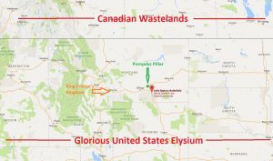
While, the location of the battlefield is here, and I added in Pompeys Pillar for a pertinent-to-this-post reference:
The battle happened here because there was a large Indian village/encampment located in the Little Bighorn River valley consisting of members of the Lakota, Northern Cheyenne, and Arapaho tribes. So, as the 7th cavalry Regiment – a still existent (today) regiment which had been formed in 1866 just after the Civil War and subsequently consisted mostly of veterans – was tasked with raiding hostile (and really any) Native Americans in the Western plains it makes sense that they would find their way to such a large encampment. Now, the 7th cavalry Regiment were no pushovers, and in fact from 1866 to 1881 they would march at least 181,692 miles across the Kansas, Montana, and Dakota territories to protect the westward expansion of pioneers . So, even if you consider their overall mission to be be pretty shitty, the fact that they were mostly veterans and had a rough job meant that they were far from greenhorns. Of course the 7th cavalry Regiment, despite their successes during the American Indian Wars, are probably most famous for their crushing defeat at the Battle of the Little Bighorn and also for carrying out the Wounded Knee Massacre in 1890 where they slaughtered a bunch of Lakota women and children (as well as men) and ended the American Indian Wars – and somehow 20 of them got Medals of Honor for this.
Still, as they marched westward (despite being a cavalry unit the 7th were known for being just as effective on foot as on horse, a testament to their battle prowess) these future black-marks had yet to taint the 7th’s record. In fact they probably felt pretty confident, as they were being led by George Armstrong Custer, and under his direct command were officers such as Marcus Reno [2nd in command to Custer], Frederick Benteen, Myles Keogh, and James Calhoun (Custer’s brother-in-law) – all of whom were combat veterans and all of whom but Calhoun had previous experience in command. Plus, prior to the battle the Custer Batallion (part of the 7th, which was itself under the regiment-wide command of Colonel Samuel D. Sturgis – to whom Custer was his chief Lieutenant Colonel) numbered around 700 men in total. Their numbers, when coupled with their ample supply of Colt Single Action Army .45 caliber revolvers and .45-55 Springfield carbine rifles (plus a few sabres, because swords are cool), would have given them reason to be confident. To make them even more confident, estimates of the number of hostiles in the enemy encampment were around 800, and in fact the 800 estimate was the official U.S. Army estimate which was not only accepted by Custer, but also by Colonel John Gibbon and Brigadier General Alfred Terry (also of the 7th but their forces were not engaged in the battle and only arrived afterwards). The problem with the 800 number is that while it may have been accurate at one time, by the time Custer had arrived the tribal forces had grown to as many as 2,500 soldiers and they were better equipped than the 7th was anticipating. Plus, at the actual time of battle the Custer Battalion only had 647 men at its disposal, not the full 700.
Custer’s overarching goal was of course to defeat the encampment, but they were hoping to avoid a large-scale resistance and to instead quickly assault the camp and capture women, children, the elderly, and the disabled to use as hostages and human shields to force the Native warriors to surrender. While this is arguably a “dirty” strategy, one cannot deny that it would probably be quite effective – and Custer had history of successfully using such tactics in previous battles. So, in essence, the 7th had a goal of storming in and exploiting the opposing armies weakness (civilians) to force a surrender, something which were later come to be known as blitzkrieg. So that was the plan as the 7th set out on the bluffs above the Little Bighorn River, looking down at the village below.
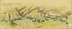
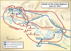
This image does a fairly good job of giving you the lay of the land, and while the troop movements are jumping ahead a bit in my story, you can better visualize things with this map.
Well, as you can probably guess, when you are expecting 800 and then there are as many as 2,500 hostiles things go to shit real quick. Major Marcus Reno (who as a reminder was second in command) was the first to attack the village. They would have advanced following the routes in the above photo, then down and across the river to the village beyond.
Custer had ordered Reno to advance because he got word from his Crow scouts that the village was being alerted to the 7th’s presence, which would have foiled his plans. So, Reno and his detachment (Companies A, G, and M) advanced towards the village, however he suspected a trap as he got closer to the village and ordered his troops to form a skirmish line where they then engaged the native warriors. The problem with “stopping” was that it allowed the Indians to begin responding en masse to the attack and within amount 20 minutes it was estimated that Reno’s forces were outnumbered 5 to 1. Things only got worse from there, as forces possibly as large as 500 Indians began attacking Reno’s left flank. By this point it was obvious that the entire quick-strike plan had gone to hell, and to make matters worse Reno’s trusted and senior scout Bloody Knife (Arikara) had just been shot through the head right next to Reno (7th lore has it that Bloody Knife’s blood and brains had splattered all over Reno, freaking him the fuck out). So Reno ordered his men to rout back across the river and towards the bluffs on the other side – rather than push forward as planned – which turned out to be a costly retreat as the Indians swarmed them from all sides and from the bluffs above. Reno’s men continued their rout until they reached the top of a bluff which is now known as Reno’s Hill, where they began entrenching themselves.
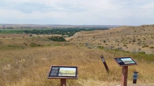
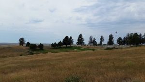
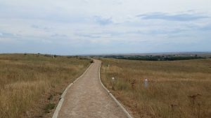
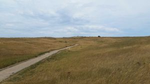
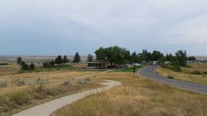
And with that hilltop entrenchment in mind, let’s jump 140 years into the future to my visit, as my first stop was Reno Hill. When you first come into the park its just a short drive to the Visitor’s Center and “Last Stand Hill” is just beyond that. But you can continue on for about 4.5 miles to Reno’s Hill – a thing which oddly few people seem to do, but it was where I started because I wanted to work my way back to Custer’s Last Stand. Once beyond the entry area the crowds plummet and you take in scenic drive across the battlefield.
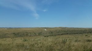
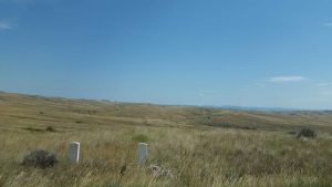
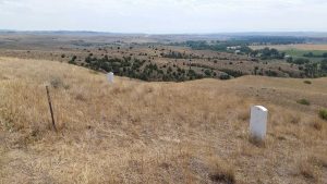
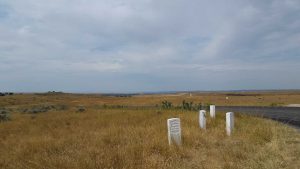
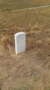
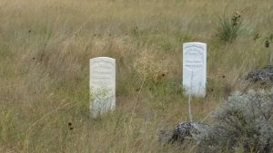
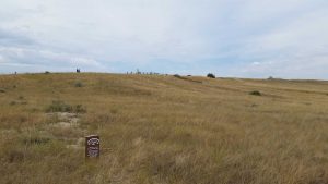
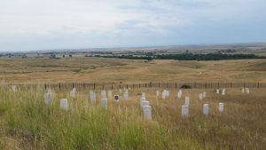
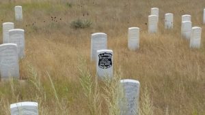
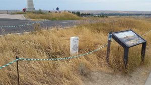
As you drive you begin to notice a myriad of white markers dotting the landscape, these are the spots where soldiers fell.
It’s actually kind of interesting and sobering at the same time, namely because it’s unusual to see markers laid out in the exact spot of death, rather than neatly lined up in rows (though I’d seen this before at the Battle of Tippecanoe site).
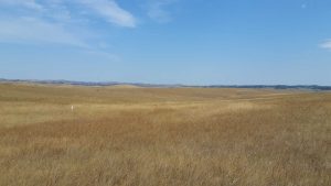
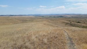
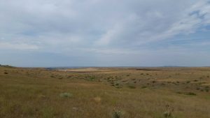
As you drive across the vast area you can only imagine what it would have been like to be exposed out here in the scorching heat, not knowing where the enemy was hiding in the grass or beyond the distance knolls.
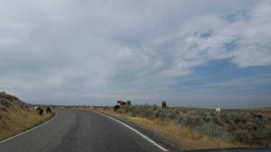
Though as a testament to the fact that ka works the world moves on there were wild horses meandering about the battlefield (I get closer to them in a bit).
In fact, in spite of its history the entire area was almost eerily silent and calm.
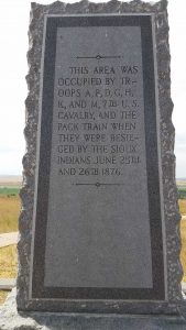
Once you’ve followed the road for awhile (which isn’t hard as there is only one road) you come to Reno’s Hill, which is easy to find because it is one of two places in the entire area with a parking lot and it also has a large stone marker.
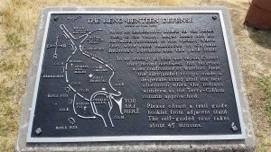
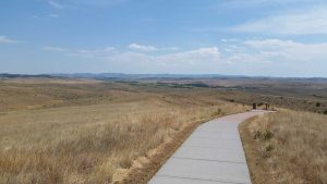
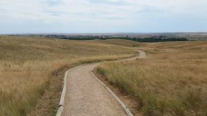
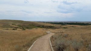
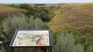
This area has a really well done self-guided trail with surprisingly well cared for walkways, the only real downside is the pounding sun. They also have some really informative signs, such as this one located adjacent to the stone marker.
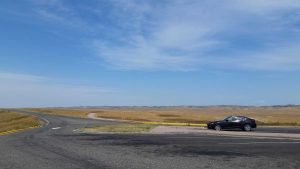
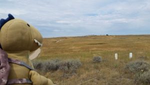
Here is what the area looks like when facing the opposite direction of the marker, Moose III gives you a nice sense of scale.
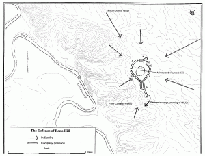
So, let’s revisit Major Reno and his troops on that fateful day in 1876. After retreating and then entrenching their formation looked essentially like this (which is also displayed in more detail in the sign two photos above).
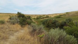
The men were tired and shaken and they’d just suffered heavy losses while making their retreat. You can see the ravine they retreated up through in the following photo.
With Indians behind them, and on the cliffs on either side of them, it’s no wonder that Reno’s retreat was such a blunder. Once at the top of the hill, Major Reno’s embattled forces were joined by Captain Frederick Benteen’s forces, which likely saved Reno from complete annihilation. These forces were further joined by Captain Thomas McDougall’s Company B – which was the supply train – which brought their forces to 14 officers and 340 soldiers. They were entrenched enough to hold the Indian forces at bay (they dug trenches with knives, eating utensils, mess plats, plans, their hands – really whatever they could find) and the troops were even able to establish a makeshift field hospital at the center of the camp, the location of which is marked by the “Red Cross” marker below.
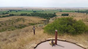
Here is a broad view of what Reno, Benteen, and McDougall and their forces would have seen from the top of the hill, and by this point they would have been almost entirely surrounded.
The fact that Benteen had stayed put – and essentially allowed the camp to become surrounded – is of grave importance for the battle as a whole (and is still hotly contested to this day), but we’ll revisit that in a moment.
As the troops were now held down by a vastly larger Indian force, they could do little but take cover and return fire just enough to prevent a charge. What’s really fascinating is that lot of the trenches, rifle pits, and mounds are still there to this day. You can see one just beyond Tristen and the path.
Now, the good news for Reno and company was that with reinforcements they had staved off their immediately annihilation, however, they were now stuck on an exposed hill in the burning sun and had no way of effectively gathering an additional supplies. The foremost issue with this was that they were quickly running out of water, and eventually the soldiers were putting things like pebbles in their mouths and chewing on grass in the hopes of salivating or obtaining some meager amount of moisture. As a result the commanders knew that they’d all die without water, so Benteen – despite having had the heel of his boot blown off by a Native bullet – lead a counter assault with McDougall which pushed back the Natives who had been slowly crawling up the hill and allowed the 7th to establish a larger position. From here, with Benteen and McDougall’s forces on opposite sides of the “start” point, a group of soldiers volunteered (or drew lots – accounts vary) to run to the river – well beyond the safety of cover fire – and retrieve water. Each man was carrying as many canteens as he could reliably hold and those who were able also toted large camp kettles with them. Once they broke out of the entrenchment these men had to run through about twenty-five yards of completely exposed field before they dipped down into a ravine which required yet another 35 yards of running, and from the mouth of the ravine to the river was about 20 more yards. While in the ravine the men were decently protected from enemy fire due to the cover Benteen and McDougall’s forces could provide against any enemies exposing themselves to fire down into the ravine. However, in the first and second exposed portions the men were completely vulnerable. Several contingents made this run over the course of the day, and while there were certainly several injuries, actual losses were surprisingly few – likely due to the cover fire and the heat of the day itself. Still, of those men who made the run for water most were later awarded the Medal of Honor – though, sadly unsurprisingly – the Indian army scouts who had also made the run were not. This area is now known as “Medal of Honor Point” and you can see the ravine they relied on for cover just beyond Tristen.
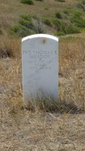
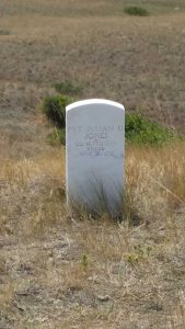
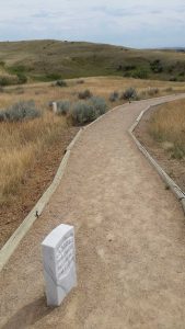
Just beyond that point are the markers for Private Julian D. Jones and Private Thomas E. Meador.
The unfortunate reality of a chaotic battlefield in such a remote area is that we often don’t really know where a specific person died. Sure, we may know where a body fell, but in most cases we don’t know much more about about the person other than what company they were part of. However, in the instance of Jones and Meador, survivors of the battle recounted not only the nature of their deaths (sniped along the lines) but the location, and so these markers bear their specific names.
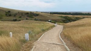
From there the path continues along to the southern point of Reno’s encampment.
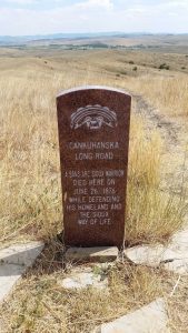
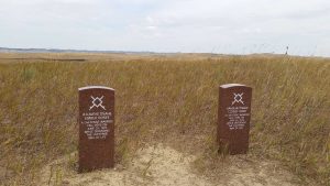
This is where I encountered my first “Red” marker, which marks the location of a fallen Native warrior. These markers are far fewer, not because their were few native causalities, but because the locations that the native warriors fell were almost universally lost to time due to their quick recovery. In fact, another misconception is that the Sioux forces had essentially no losses and this is far from the truth. In fact, they lost 136 warriors, 6 women, and 4 children during the course of the battle and may have had as many as 160 more wounded. While these losses were fewer than the 274 suffered by the 7th (plus 49 wounded) you have to keep in mind the difference in the size of the forces (possibly as many as 2,500 vs 647). So this was hardly a “lossless” battle for the Sioux alliance, but it was a crushing defeating for the 7th.
However, where they do know where a native warrior fell, it’s been marked with a red marker.
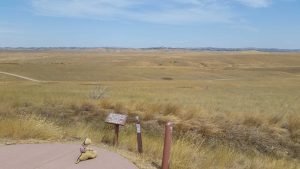
You can see another one in the distance here, this was one of the perimeter hills that the native warriors were slowly creeping up through the grass.
Here’s a wide angle shot looking the opposite direction from the photo above, this would have been looking back towards the center entrenchment. You can see Jones’s and Meador’s markers to the far left.
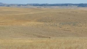
And here is a closer shot of that far marker from two photos above, a sizeable number of native warriors would have been hidden in that valley just in front of the fence.
As the trail loops back towards the center of Reno Hill’s you pass the eastern line of rifle pits and trenches.
This next photo would have been the “core” area of the entrenchment and if you look closely you can see the field hospital marker.
Now, while I mentioned that they know where a fair number of the bodies were, they don’t know where all of them are (something I’ll discuss more in a bit), and of those bodies where they know the location, for some of them they have no idea which company they were part of or really anything at all about them. Such is the guess with this “Unknown Soldier” marker.
When Brigadier General Alfred Terry reinforcements arrived (two days too late for a large portion of the Custer Battalion) they didn’t have much time to search for and bury bodies – and in fairness to them they were deep in what was still hostile territory at the time. As result an unknown number of bodies were completely missed and most of these bodies will never be located. However, one such body was later found – as a skeleton – and they put this marker on the spot.
I had an almost ethereal experience as I approached this marker, it sent chills down my spine and made the hairs on my neck stand up, and even just recounting it has done the same. As I was walking up the path I noticed the wind moving through the expansive fields of grass (amber waves of grain style) and as it was so open, I could see the wind moving long before I could feel or hear it. It was right when I got in front of the marker that the wind met me, and for a brief moment I felt like I wasn’t alone. I understand, rationally, that my mind was in all likelihood creating this effect. But it was quite profound to watch that wind approaching me in the grass and then to have it connect with me right at that spot – of all the miles and miles of battlefield – it was that spot. It’s something I’ll never forget.
From the unknown soldier marker, if you turn to your right this is the view you get, this is facing north. If you notice that prominent hill towards the left, that is “Sharpshooter’s Hill” (also referred to as “Sharpshooter’s Ridge”).
The hill gets its name for a predictable reason, it gave the Indians a clear shot down into Reno’s Encampment. So, since they knew the gravity of their situation the Indians sent their best shots with their best rifles up onto that hill. There are some survivor accounts of the native sharpshooters on this hill that in modern hindsight are semi-comical, namely because of how furious they were at the sharpshooters but at the same time couldn’t help but be amazed by how good of shots they were. Consequently, when they managed to take out what they believed to be the best marksman out on the ridge (who’d killed at least three, if not more, of the 7th) they were quite happy about that. Here’s a slightly more focused view of the hill.
So what happened to Reno and his entrenchment? Well, as mentioned, Reno and his men all but certainly owe their life to Benteen and his forces, and further to McDougall and his supply train which allowed the entrenchment to continue its suppressive fire. So, they stuck it out for two entire days, slowly being picked away by the encroaching Sioux warriors. However, at the end of the second day the entirety of the Sioux forces vanished. The Sioux scouts had reported back that General Terry was approaching from the north with an entire column of 7th cavalry and so they drew back into the southern hills. Interestingly enough, the entrenched Reno forces had no idea Terry was on his way and they thought that the routing native forces were attempting to lure them into a trap, so they remained up on that hill for another entire day – hot, thirsty, and with lots of wounded – for fear of ambush. It wasn’t until Terry’s forces arrived that they had any idea that the battle was actually over. So while the Battle of the Little Bighorn was “officially” 2 days, if you spoke to a Reno survivor they’d likely say 3.
But the story isn’t over. You’ve probably noticed that I didn’t mention Custer. That’s because Custer was already dead when most of the above happened. In order to understand how and why, we need to jump back 3 days to Reno’s initial assault on the Indian village. Custer wasn’t expecting Reno to stop short of the village and more importantly, neither man expected there to be over 3x as many soldiers as they were expecting. So, while Reno was attacking from the south, Custer had moved further north to initiate a northern assault. The plan was a simultaneous attack from both directions, but given Custer’s information that the village was quickly becoming alerted to their presence he ordered Reno to attack early. Thus, when Reno’s attack failed, Custer was located 4.5 miles to the north, meaning that the Custer Battalion was now divided into two and the vast majority of the native warriors were near Custer, while most of the 7th’s reinforcements were in the south near Reno. This put the battlefield roughly as follows:
The reason the majority of the native forces were free to attack Custer was largely because of Reno’s earlier rout. Once Reno had “dug in” at the top of Reno’s Hill – and more importantly – Benteen and McDougall had stopped there, the native forces realized that Custer was stuck way out by himself. In essence, they just swarmed the weaker target and most likely knew that Custer was in that group and that they’d be able to “cut the head off the snake” if they pushed the assault on Custer. Now, Custer’s plan was to cross the river, specifically at crossing known the natives as “Minneconjou Ford.” However, we actually have no idea if Custer ever made it to the river. Accounts vary wildly on the native side, and as Custer’s forces were completely wiped out, there are no accounts from the 7th. Some put Custer across the river in an assault that was driven back, some put Custer in the river and routed, some put Custer at the river and being routed, and others put him nowhere near the river and instead suggest that he was met up in the bluffs. From what I’ve been able to gather, archeological evidence seems to most support the premise that at least one of Custer’s companies made a forward assault and was driven back, but just how large this push was we may never know. Regardless of any offensive, the end result was that Custer’s forces were driven back (or stuck from the outset) to a hill which is now infamously known as “Last Stand Hill.”
So, returning to the present, Tristen and I began to make our way back from Reno’s Hill to “Last Stand Hill.” On the way we discovered that some of the wild horses had moved much closer to the road.
On the way towards the hill there is a dip in the landscape and it was here that James Calhoun (who, as mentioned, was Custer’s brother-in-law), while acting as temporary commander of Company L found his forces under heavy assault as they moved towards Custer’s location.
Calhoun’s forces fought towards Custer’s location, but their loses only continued to mount. You can see the string of markers below.
They did make it to the “battle ridge” that Custer’s forces had formed, but due to the assault found they could go no further than what is now known as “Calhoun’s Hill” which was the hilltop at the opposite end of the ridge from where Custer’s forces were gathered. Here Calhoun and his second in command, Lieutenant John Crittenden formed what was left of their forces into a defensive perimeter and fought fiercely to the last man before being overrun. In fact, Calhoun and Crittenden were found dead within just a few feet of each other. The collapse of Calhoun’s front further exposed Custer’s hill and the natives forces subsequently surrounded it quite quickly.
Of course the fighting between the native forces, Company L, and Custer’s troops resulted in a deluge of gunfire that lasted for quite some time. 4.5 miles away on Reno’s Hill several noted particularly distinct volleys coming from the north around 4:20pm, but Captain Benteen did not move his forces (Companies D, H, and K) north to reinforce Custer and Calhoun as it was believed he had been ordered. Instead he stayed put at Reno’s entrenchment and as discussed above likely prevented Reno’s forces from being wiped out. This is a large point of contention for both the military, historians, and even the native peoples. Some argue that Benteen could have saved Custer if he would have followed orders and proceeded to the North. Others say that Benteen did the best thing he could in that he stayed to save Reno’s forces and that if he had pushed on to Custer then both divisions would likely have been wiped out instead of just one. No one argues that Benteen fought bravely and admirably at Reno’s Hill (in fact Reno himself largely gave credit to Benteen and McDougall after the battle), but as to whether the battle would have played out differently if he’d continued northward is a matter of much debate. Regardless, Benteen was able to maintain his reputation, whereas Reno and his disastrous charge and retreat are now normally listed as one of the principles causes for the defeat at Little Bighorn – and really Reno suffered the worst blow to his reputation of any commander in the battle (including the dead such as Custer himself), though just how deserved this was is also disputed.
The fact of the matter, as that irrespective of what he should or could have been done Benteen (nor McDougall) never moved forward to reinforce Custer, and once Calhoun had fallen, Custer was left stranded 4.5 miles away from Reno’s forces and completely surrounded by the vast majority of the native forces. Yet not everyone with Custer would participate in that infamous last stand. At some point, and there is disagreement over when, a contingent of Custer’s forces (believed to be Company E) attempted a “break out” to the river beyond the bluffs. Their likely route is along what is now called the “Deep Ravine” trail, so named for the Deep Ravine at the end of the trail where he bulk of the breakout force supposedly met their end.
This is towards the top of the Deep Ravine trail, that’s the Custer National Cemetery in the distance, which was established in 1886 and closed to new interments in 1978.
While the Deep Ravine trail is a bit more rustic than the trail out at Reno’s Hill, it’s still in fantastic shape.
Along the trail – which is believed to have been the “break out” route – there are markers where the soldiers fell. One particularly storied marker is that of Second Lieutenant James G. Sturgis.
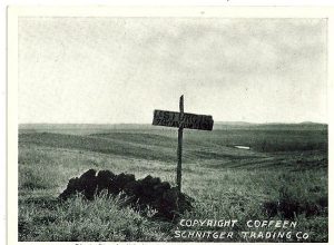
Now, we don’t know for sure what happened to Sturgis, which might seem odd given that the marker above clearly says that he “fell here.” Yet, as is often the case, history isn’t so simple. Sturgis did not survive the battle, of that we are certain. But whether he was ever actually found is up for debate. There is evidence that some of his bloody gear was discovered in the Indian village after it had been abandoned prior to Terry’s arrival, but then there is also evidence – albeit with slightly less provenance – that they found Sturgis’s decapitated head in the village as well. Either way, whether his body was missing or was found mutilated, he certainly didn’t die where his marker is. That marker is located on that spot because after the battle had passed, Strugis’s aggrieved mother wanted to visit the spot where her son was buried. So, out of kindness to her, the 7th hastily built a stone cairn and put a sign on it marking it as the spot Strugis had fallen.
They figured – correctly I would guess – that it would be easier for her to visit a “grave” than to tell her that he had likely been cut into pieces and decapitated and/or never found. So, as a continuation of this they placed the modern marker right where the “fake” original marker was.
In fact many of the markers along the Deep Ravine “breakout path” are approximate at best, this is because of the confused nature of the attempt and the fact that many of the bodies had been moved. Thus, most of these particular markers are simply estimates.
However, there are a couple, such as that of Mitch Bouyer where we know with quite a high degree of certainty where they fell.
Bouyer was an interesting character, born of a French Canadian and a Santee Sioux, Bouyer was largely raised as a Sioux after his father (the French Canadian) was killed by Indians while trapping. When he was older Bouyer became a scout for the 2nd cavalry though Custer later requested him specifically to assist in his efforts to build relations with the Crow Indians and utilize them as scouts. Unfortunately for Bouyer, he took the position and was later killed at Little Bighorn. For a significant period of time after the battle historians believed that Bouyer died on Last Stand Hill, however after a 1984 fire burned away most of the Little Bighorn Battlefield – allowing archeological digs on an unprecedented scale – part of a skull was found which through extensive testing was determined to be Bouyer’s. This confirmed that Bouyer was most likely not at the top of the hill, but instead deep in the “South Skirmish” line where the breakout attempt occurred.
In the following photo Tristen is looking towards Last Stand Hill and this is the perspective that the bulk of the native forces would have had as they progressed forward. You can see Bouyer’s marker to the right of the screen.
Turning around from the above photo, you then continue further down the Deep Ravine trail, away from Last Stand Hill.
Interestingly enough some of the markers are in the trail, I’m not sure which came first, but I thought that was an odd design choice either way.
Additionally, not all of the markers were facing the same direction but I wasn’t able to determine from the trail guide whether or not this was meant to convey the direction the person was facing when they fell, or if it was just due to soil conditions.
Once at the end of the trail you reach the “Deep Ravine” itself. Here is a shot of it facing towards the river:
And here is a shot facing back towards the main battlefield:
The Deep Ravine is an interesting spot because we haven’t been able to definitively determine whether or not any of the breakout forces made it there. Native accounts unanimously agree that fighting occurred here and that around 28 US soldiers died fighting in the ravine. However, that’s about as much evidence as we have. It certainly seems probable that the breakout forces would flowed into this ravine, as it would have been the path of least geological resistance during a downhill run. However, no actual remains have been discovered in the ravine, and Lieutenant Charles F. Roe – who was tasked with determining the proper locations for burial markers after the battle – said that most of the bodies were located above the ravine, and that only 2 or 3 were actually in it. That said, it’s entirely possible that bodies were missed, or moved, or some combination thereof. The most effective way of determining if bodies were in the ravine would be to do an archeological search for them but that would be quite disruptive to the ground and permission to do such a search has never been granted. However, a study was done using ground-penetrating sonar which detected lots of anomalies and metal, but this wasn’t an affirmative sign of bodies, though if there were extensive numbers of shell cases and bullets then that would suggest that there was indeed heaving fighting in the ravine. Further supporting the idea of in-ravine fighting was that the ravine was known to act as a “drain” into the Little Bighorn River during heavy storms, and as such its not impossible that most of the bodies deep in the ravine were simply washed away.
Still, without more detailed searching – which isn’t likely – we may never know exactly what happened in the ravine, but even the National Park Service seems to think that a lot of the markers along the Deep Ravine trail probably belong closer to – or in – the ravine itself. Regardless of how far they made it, none of the breakout group actually “made” it, as they were all dead before they reached the river.
Once done down in the ravine I started heading back up, as it is an out-and-back trail. Here is a nice wide view of Last Stand Hill in the distance.
There are even a few native warrior markers here, which like those throughout the rest of the battlefield are kind of surprising given that there is only an oral history – but they are simultaneously a testament to the accuracy of that history when so many people agreed on where a certain warrior fell.
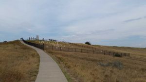
The Deep Ravine path connects to the path up to Last Stand Hill and from there it’s just a short walk away.
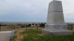
Here is a view from near the top of the hill, facing towards the river. This is what Custer’s forces would have seen, except with the bulk of the native forces creeping towards them. That marker with black on it is Custer’s, but I’ll get to that in a moment.
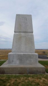
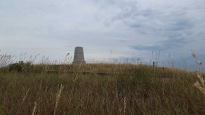
At the peak of the hill is a stone obelisk. This memorial was placed in 1881 and at the same time the bodies of the fallen 7th Cavalry soldiers from the immediate area were dug up and then re-interred around the base of the monument (though their original memorial stakes were left where they fell). The original markers – at the spot of death – were replaced by marble blocks (the precursors of the modern marble markers) in 1890. As a result, a good number of the remains from Last Stand Hill (not the whole battlefield) are now under/around this monument.
Of course this makes one wonder if Custer is there too, since not only did he and all his men die there, his two younger brothers Thomas Custer and Boston Custer and his nephew Henry Armstrong Reed also died at Last Stand Hill as well – making this quite a sad family affair for the Custer family (remember that Calhoun was Custer’s brother-in-law, though he died at the opposite end of the ridge as mentioned above). Of the many questions about Little Bighorn, we do know the answer to this one, and no, Custer is no longer at Last Stand Hill nor are his brothers, nephew, or brother-in-law. That said, Custer’s body did lie buried at Little Bighorn for some time, but first let’s discuss just what happened during “Custer’s Last Stand” so we can understand the final moments of Custer and his men.
The unfortunate reality is that we know surprisingly little about the last stand, precisely because all of the US soldiers were wiped out and subsequent Indian accounts are inconsistent, for instance no fewer than a dozen native warriors claimed to have killed Custer. As such, we have to patch together the consistent pieces of oral history alongside the archeological record (largely built after the 1984 fires) and the period accounts of 7th cavalry survivors who came to the site after Terry’s arrival and the later 2nd Cavalry recovery forces who were in the area of the hill. From this patchwork we’ve been able to credibly (though far from definitively) establish the following things:
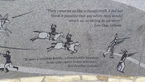
For starters, Custer’s last stand likely lasted no more than an hour and may have been over in as little as 30 minutes. They were grossly outnumbered by the native forces and despite most of the native losses occurring at last stand hill – by the Lakota’s own accounting they lost more men here than anywhere else, likely due to the fact that Custer’s men knew they were doomed and thus fought to the bloody end – all that was needed was a large native surge to overrun the position, which is essentially what happened. However, it’s likely that Custer was able to maintain (or reestablish) order on the hill, because they not only established perimeter positions, they shot their horses used their bodies to form a circular wall of cover (breastworks) – definitely not PETA approved, but also effective. Also, not every man would have been blobbed up at a the summit surrounding Custer – as is so romantically portrayed in many paintings. In reality Custer’s remaining forces, their animals, supplies, and all the wounded would not have fit on the hilltop. As such there were likely little pockets of “last stands” around the hill with Custer’s being the largest and most central of them at the top of the hill. Even after Company E had made their ill-fated breakout attempt, there were probably 50 to 60 men left in “last stand” mode which was too many to effectively function in such close quarters as would be required at the top of the hill. So, just how many men were in the final stand is debatable, but if you are envisioning all 210 of Custer’s original contingency then you’ve grossly overestimated the number on Last Stand Hill. Still, this doesn’t mean it was an entirely one-sided slaughter. As mentioned the native forces suffered heavy causalities while taking the hill and many native survivors commented on the fierce fighting that the soldiers on last stand hill maintained until the end, one such example being Sioux Hunkpapa warrior Moving Robe who said “It was a hotly contested battle” and another being Red Feather, a Lakota warrior who said “It was a terrible battle … a hard battle because both sides were brave warriors.”
And while we don’t, and won’t, know the specific details of last stand hill, one thing is certain: no matter how valiantly they fought, Custer and all his men died to to the man. After this happened most of their corpses were stripped, scalped, and mutilated. In fact it is believed that Rain-in-the-Face, a Lakota war-chief who had escaped captivity after being arrested for murder, cut out Thomas Custer’s (George’s brother) heart after the battle, a claim which Rain-in-the-Face subsequently denied. Still, whether or not his heart had been cut out Thomas had to be identified by a tattoo on his arm, so extensive was the damage to his body. Custer himself was found with two bullet holes, one in the left temple and one just below his heart – either of which would have been fatal but Custer had only bled from the chest wound, suggesting that he’d be shot in the head postmortem – however the evidence on the bleeding is much more flaky than that of the two bullet wounds, so we know he was shot twice – and it was believed to have been rifle rather than handgun ammunition – but as to whether any shots were delivered after death we can’t be sure. Either way, Custer was definitely dead, and while we can’t be sure whether or not the Indians moved him much, most evidence has him placed as falling pretty close to the top of last stand hill. This is difficult to pin down though because there is also evidence that native women with clubs came in and finished off any wounded soldiers – not to mention the native warriors scalping or otherwise mutilating the bodies. So, the best we can guess it that Custer died near the top of – but not perfectly on top of – last stand hill.
So if that is the case, then why is his marker in the center of the cluster of markers on “edge” of the hilltop?
Well, the answer isn’t anything devious or intentionally misleading. The troops simply buried him in the geographic middle of the “pile” of dead 7th cavalry soldiers, basically so that his men were surrounding him, even in death. They also buried him immediately next to his brother Thomas Custer, while brother Boston Custer and nephew Henry Armstrong Reed were buried a bit further away, but still in the “last stand” cluster (brother-in-law Calhoun was buried were he fell on Calhoun’s hill).
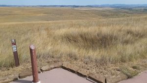
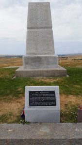
As for where Custer most likely fell prior to being buried, it would have been right between the “The Memorial” plaque and the obelisk in the photo below.
And while Custer wasn’t buried in that spot, as mentioned, most of his men now are.
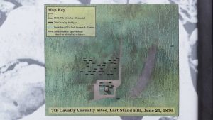
Here is a pretty interesting “map” of where the bodies were most likely initially found, you can see a blue box representing Custer – and for reference his modern black marker is located in the middle of the upper cluster of black boxes.
So what happened to Custer if he didn’t remain here on this ill-fated hillside with his soldiers?
Well, about a year after his body was initially buried, it was dug up and sent back east where he was re-interred with full military honors at the West Point Cemetery (Custer was a West Point graduate, though he oddly was last in his class of 34 cadets despite going on to a highly decorated military career – up until Little Bighorn that is). His younger brother Thomas Custer was also exhumed and moved to the Fort Leavenworth National Cemetery in Leavenworth, Kansas. His youngest brother Boston Custer was likewise exhumed and moved to Woodland Cemetery in Monroe, Michigan. Custer’s nephew, Henry Armstrong Reed was also moved to Woodland Cemetery, though in a bit of macabre history his scalp – removed by the Indians after the last stand – is on display at the Museum of World Treasures in Wichita, Kansas – I’d love to know the provenance on that thing. Similarly, Custer’s brother-in-law James Calhoun was also exhumed and sent to Fort Leavenworth National Cemetery. While the Custer family was obviously quite prominent, it was common practice at the time for commissioned officers to be shipped home for reburial whenever possible – so many other officers (at least those whose bodies were positively identified) were also shipped to their various final resting places. As for the foot-soldiers and officers lost to time, they remain either at the top of last stand hill, or where they fell elsewhere on the battlefield. From what I can gather there were few – if any – native warriors who were actually buried on the battlefield since their bodies were all able to be recovered prior to Terry’s arrival.
Of course when speaking of the dead we can’t simply stop with the soldiers, we must also consider their mounts, this was the cavalry after all. Plus, if the evidence is correct then the soldiers at last stand hill probably owe a good deal of their stalwart final resistance to the animals they killed to use as a barriers. As such, just past the obelisk on last stand hill is the “7th Cavalry Horse Cemetery.”
While the horses obviously weren’t originally buried, when the 2nd cavalry recovery force came through they interred the skeletal remains of the “last stand” horses just beyond the mass grave of the soldiers. I actually thought this was pretty cool, and considering that this was the 1800s, it was also a testament to how much the cavalry valued their steeds (as either a method of locomotion or a corpse wall apparently).
As I left last stand hill I could help but feel a bit mixed in my emotions.
On one hand, I think there is scarcely anything more emotion-inducing than a doomed last stand. Call me a sucker, but four of my favorite military sites in the world are Bunker Hill, Little Bighorn, the Alamo, and Thermopylae, notice the pattern? Regardless of what brought them there, you can imagine that a lot of these men, especially the foot-soldiers, probably don’t deserve the bitter eye history as cast upon them in the past few decades (as we have become more aware – or at least more acknowledging of – the atrocities committed against Native Americans). On the other hand, what the 7th cavalry was doing was pretty much indefensibly awful. Imagine if tomorrow someone decided they wanted your house, so they basically said “Get out or we’ll kill you.” So you get out, but then they go to your neighbors house and do the same time, and this continues until your entire family, your entire town, your entire culture has been forced out of the home you’ve had for countless generations. So you decide, after being pushed and pushed and given nothing in return, to resist, and what happens? They slaughter all of you, not just the ones who fight, but all of you. That’s basically what the U.S. Army did to the Native Americans, and in spite of their individual heroism, the men of last stand hill were a part of this campaign.
So I was conflicted, torn between the honor of a U.S. soldier fighting fiercely to the very last breath against overwhelming odds on one side, and on the other side a force of oppressors who by their own foolishness had met their doom at the hands of the oppressed. It’s a conflicted set of emotions that I don’t think you have to resolve to fully appreciate the Battle of the Little Bighorn, precisely because the battlefield, which was until 1991 called “Custer Battlefield,” has now been converted into a memorial for both sides.
See, the thing is, Sioux alliance may have won the battle, but by God above did they lose the war. In fact, the Battle of the Little Bighorn has even been referred to as the “Indian’s Last Stand,” namely because such a devastating defeat meant that the United States would choose to repay their losses in savage kind. Further, because the Native Americans were accustom to living off of game and grass for their animals they were unable to maintain such large and local forces. As s result, the huge forces of Little Bighorn broke off into smaller and smaller groups until eventually only about 600 at-large and hostile native warriors remained. The capture and later deaths of both Sitting Bull and Crazy Horse only further doomed native resistance and the arrival of larger U.S. military forces and artillery (and the newly minted Gatling Gun – put to devastating use at Wounded Knee) was the death knell. So while the natives rightly celebrated their surprise victory at Little Bighorn, in the grand scheme of things it was the beginning of the end for them as well.
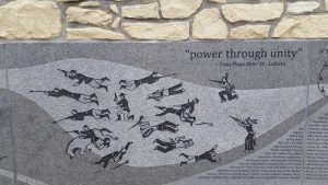
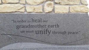
So, it was only appropriate when the name of the battlefield was changed in 1991 that the name-changing bill is also called for an “Indian Memorial” to be constructed on the site. After all, while Custer and his men had lost their lives, the Indians had lost their way of life after the battle. In 1997 a winning design was chosen by the National Park Service from around 500 entries with the theme of “Peace through unity.”
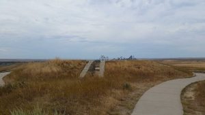
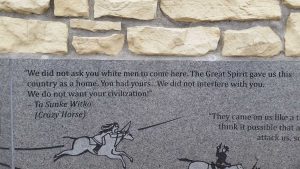
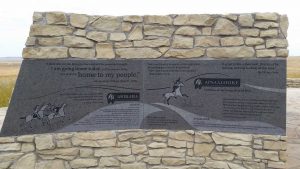
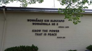
I was honestly kind of expecting the Indian Memorial to be a bit lackluster, but in actuality it was really well done, just as good as the rest of the battlefield. Inside the circular mound they have quotes from Native Americans involved in the battlefield, and I particularly liked this quote from Crazy Horse:
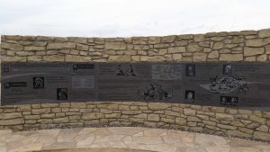
There are also first-person accounts of the battle itself:
The artwork wasn’t solely made for the memorial, but was instead copied from original Native American pieces depicting the battle.
Not all of the quotes were aggressive, and in fact Sitting Bull’s wise words seemed to contrast against the aggression of Crazy Horse and highlighted an unease among the Indians themselves.
In addition to quotations, the circle also contained information about the various tribes involved in the conflict.
It was really interesting to get the native perspective on the battle – a perspective quite frequently lost in America.
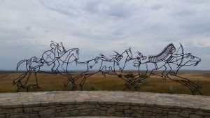
Then, completing the circle are three wire-frame warriors (and one of their wives) riding off to war – to defend their history and people – the vast plains of past and present extending to the horizon beyond them.
As I descended back towards the visitor’s center I was really quite touched.
Rather than feeling like the battlefield was devoted solely to Custer, or his men, or really our side of things, I felt like – at least at present – there was a bonafide effort to portray the battle for the role it played in the larger American Indian Wars, wars which largely put us in the role of a villain. It felt like I could simultaneously respect the sacrifice of the 7th cavalry, while also realizing that they never should have been there in the first place. I realize that this probably seems contradictory, but it makes a lot more sense when you’re standing out on those grassy bluffs feeling the wind in your hair. It’s not something I can’t convey via the internet (as is true with so much).
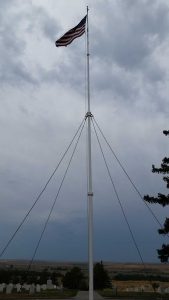
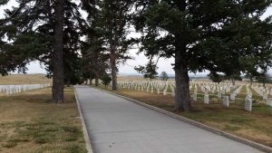
Once back down by the visitor’s center I took a quick stroll through the cemetery, where I was especially moved by the following two signs:
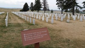
The muffled drums sad roll has beat,
The soldier’s last tattoo,
No more on life’s parade shall meet,
The brave and fallen few.
And:
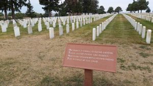
On fame’s eternal camping-ground,
Their silent tents are spread,
And glory guards with solemn round,
The bivouac of the dead.
To be candid for a moment, if you have no idea what the hell a “bivouac” is (I didn’t either) it’s a temporary camp without tents or cover, essentially an improvised campsite. As for the poem, it turns out that the clips on both signs are from the poem “Bivouac of the Dead” by written Theodore O’Hara in 1846. This poem apparently appears at a number of national cemeteries, though at many sites – such as Arlington – O’Hara is not credited since he fought for the Confederacy in the Civil War, talk about revisionism.
While the Custer National Cemetery has been closed to new burials since 1978, its history and immediate proximity to the Little Bighorn battlefield make it well worth visiting.
It’s also a relatively pretty cemetery given the nature of the dry and open landscape around it.
As I began the 211 mile journey back home, I kept thinking of the words of Black Elk – a Oglala Lakota medicine and holy man – which were prominently displayed on the side of the visitor’s center:
It kind of put the entire battlefield – and it’s subsequent history – in perspective. This is especially true when you consider that around 136 native warriors, 6 native women, 4 native children, and 268 7th cavalry soldiers were killed in the battle, with 160 more wounded on the native side and 55 wounded on the U.S. side (of which 6 would soon die of their wounds). In total 52% of the Custer Battalion was lost, an absolutely devastating total by any account and several companies were entirely wiped out, while on the native side the losses were also considerable and the Sioux alliance never truly re-rallied after Little Bighorn. It makes you wonder what would have happened if peace, rather than violence, had prevailed.
All in all I was extremely glad I took the time to make it out to Little Bighorn (and Pompeys Pillar). I found that I gained an extremely large amount of information, and whether you blame Reno (stopping short of the village and then hastily retreating), Benteen (for failing to reinforce Custer), or Custer himself (splitting his forces into four units, refusing a battery of Gatling guns [though contemporary military historians doubt they would have been of much use in this particular battle due the lack of cover for their operators], and inadequate reconnaissance) – the end result is that blunders were made at various levels, and as a result we have the infamous battle of “Custer’s Land Stand” to reflect on
.I hope you’ve learned something from this extensive write-up, be it that Pompeys Pillar is a thing, that Lewis and Clark – despite being bffs – did split up at times, or that there actually were survivors of the Battle of the Little Bighorn (Reno’s Hill) or that Custer lost both his brothers, a nephew, and a brother-in-law in the battle, or that the whole thing is named after a river – if you learned something, then I’ve done my job.
With a huge historical experience behind us, Tristen and I hit the road home. It was Sunday after all and we still had laundry to do and work in the morning. Fortunately the weather – while overcast again – held steady on the way back.
I was able to pay more attention to Billings this time around, and it’s an interesting (though to me largely unappealing) city where the oil derricks and refineries are legitimately located just across the street from downtown (not joking, I’m talking right across the street).
Once we got back into western, and eventually southwestern Montana, the storms from the morning appeared to passed and we had welcoming blue skies.
In fact that good weather held all the way home, as did the relatively light traffic once past Billings.
We even got to race another train on the way home.
When we finally made it home (around 10 hours and 450 miles later) there was even a deer family waiting for us! Which surprisingly Tristen didn’t try to eat.
Over the course of the day I collected three more stamps for my National Park Passport, though my Little Bighorn is upside down since they didn’t have any testing paper. I was a bit bummed by this at first, but I’ve since decided that it adds character to my passport.
That night (despite a power outage) we got some laundry done, had some beers, and then got into bed. Tomorrow was our last day of work!
The last day was the kind of happy-sad that I’ve come to expect, as both Denver and Santa Fe were the same way.
—–
[Author’s Note: Due to a blog error I lost everything below that line above and had to re-write it, as such things are bit less detailed below than they originally were, but given the length of this post I doubt you’ll have much of an issue with that 😛 ]
The one interesting thing about this last day was that I was actually quite busy right up until 5pm. While Denver had really only been a half-day complete with putt-putt, and Santa Fe had only lasted until about 4pm, Bozeman saw me in the office until after 5pm. So I guess as I’ve progressed through my internships my last days have become increasingly like real work days.
In the morning I started on my last project and then my supervisor took me out for coffee and a debriefing session, which was a nice, and then for lunch everyone in the office went out to a yummy Thai place, also nice. Once back from our long lunch, I finished up my project and then sort of spent the rest of the afternoon taking care of administrative and confidentiality stuff. Then soon enough it was 5pm and it was time for me to be on my way, and while I didn’t get out of the office until nearly 5:30 due to goodbye conversations it was a really good last day. I really enjoyed my time in that small office and it definitely reaffirmed by feelings about the kind of work I wanted to do.
The only downside to a full last day is that I still had, well… all of my packing to do and I wanted to do a bit of cleaning as well. I had hoped to get started on Sunday but when Tristen and I got back from our 450 mile road trip the power was out, and since I have a well-pump that also meant we had no water. Those utilities didn’t return until about 9:30pm so that nixed most of our preparation plans.
On the way home from work I stopped to get Moose III some food so we wouldn’t get charged the ridiculous rental car company gas prices at the airport. I also aired up the right-rear tire and reset the alarm for a third time; it had lost 8lbs of pressure during our weekend trip.
Once at home I started getting ready and I also took the time to look over the magnets I had collected this summer. They are a nice pictographic account of some of the really cool stuff I’ve been able to see and do. The red and purple ones in the upper right corner are actually stickers for the Museum of the Rockies (red was mine, purple was SB’s – not sure what color Meem’s was), though the magnet for the museum just to the left of them was actually the first one I added to my summer collection.
In order to keep the final night from being a woeful packing-fest I cracked open my final beer in Montana – Big Rig, a bitter from Deschutes Brewery – and while Deschutes is technically an Oregonian brewery, Tristen felt like the “manries” name of Big Rig made up for that as a final Montana beer.
Once we had our beer open we got to packing and between beer-sipping breaks and glancing over at the Olympics from time to time it really wasn’t a bad night. I’m a “stressed” packer and since I had even less time than normal I was a bit concerned but it all turned out fine.
I still got to bed later than I’d like (my flight was at 7:10am) the next day, but at least I slept well for those 4.5 hours I did get. The next morning I was up and around and on my way fairly quickly – though some last minute stuff took longer than anticipated, as usual. Once at the airport I first dropped Moose III off. Like Moose II and Moose I before him this was an oddly sad occasion. I’d had quite a few adventures with House Moose (as did the Boys, Meem, and SB) so I kind of associated them with my overarching adventures. Also interesting is that I’m pretty sure I drove Moose III more than Moose II or Moose I, despite only having Moose III for 1/3 as much time. In the end Moose III and I logged 1471.3 miles in 11 days.
As for the airport, something went awry in my time-schedule because I ended up only getting to my gate about 10 minutes prior to boarding, which for a neurotic like me is cutting it close. I think part of the problem was that check-in took longer than anticipated, as the United area was comparatively crowded based on how I’d seen it before (the Bozeman airport is normally pretty quiet). The problem was compounded by the fact that – like normal – most people don’t seem capable of using the self-check-in machines, and also like normal, they seem to be routing more and more people to those machines. Regardless, I was still happy I’d booked on United rather than Delta (the only two options to get to/from Bozeman to back east) because Delta had had massive system crash the day prior and thousands of their flights were still getting cancelled, including a few in Bozeman.
The good news is that security had all of like 6 people in line and so it was 5x faster than check-in, and from there I got to my gate with no problems.
More good news was that my flight was right on time with no delays, plus I’d somehow managed to upgrade my seat on both flights for free (rather than pay the $79 charge per flight) after I clicked around on the website like a madman for a while. I’m not sure how I did this, but I’m hoping I can recreate it in the future.
Before too long I was watching the runway fade away and then the airport itself, and eventually Bozeman was falling away beneath me as well. As I saw the “M” which once seemed so large – but now seemed so small – fading away behind the clouds I got quite a lump in my throat.
I found this humorous in some odd way. I’d been sad to leave for Montana and now I was sad to leave from Montana. In fact, looking back at all my internships I think I’d been more said coming back than I have being going out. I think that speaks to something.
Eventually the M was just a tiny white dot that disappeared in the distant haze and soon enough Montana itself was vanishing behind the clouds.
From there it was just clear blue skies above the cloud cover all the way to Chicago.
In fact that flight was probably one of the smoothest, if not the smoothest, flights I’ve ever had. I don’t even think we hit a single air pothole. This made for good reading time, especially with some coffee (4.5 hours of sleep) and the always awesome United Airlines Stroopwafel.
I’d started “The Wind Through the Keyhole” on Saturday (which I’d been wanting to read for 4 years), but hadn’t been able to get back to it over the past three days, so I returned to it on the flight. I’d wanted to get in more reading over the course of the summer (setting a goal of three books – as law school generally kills my desire to pleasure read) but the great outdoors and Game of Thrones nixed that. The good (for reading purposes at least) news was that I had a three hour layover in Chicago, which gave me plenty of time to continue reading, and in fact by the time I got home that evening I’d already read 90% of the book (and have since finished it).
My second flight left right on time as well, and while it wasn’t quite as smooth as the first flight, it was still one of the better flights in recent memory. I suppose the Airline Gods (or Clifford) were smiling on me that day. The one unsettling thing was that as I was flying out of Chicago I noticed that my plane had a “No Humans” tattoo which made me wonder what side of the Matrix the planes were on. If that tattoo is any indication then we have cause for alarm.
My good fortune continued all the way to Logan as we landed a bit early. The only real travel hitch was that my luggage came out on the wrong carousel and the employees stood there for 15 minutes before they told anyone (I have a bad history with luggage and Logan airport). Then the Silver Line was so crowded you couldn’t even use it at first, but hey that’s Boston. All in all, it was a really good 2000 mile trip home and for that I am immensely thankful.
SB met me along the way (she was done with her Yoga teacher training for the day) I trudged through GOD AWFUL humidity that is the Boston swampland and finally made it home around 7pm. While getting settled in I wondered how long my “Mountain Man Tan” would last out here on the east coast. This photo really doesn’t capture it very well, but I have some crazy tan-lines and as SB put it “it looks like you are wearing stockings.”
I think I got more sun exposure this summer than I have in the past decade, possibly even inclusive of Colorado.
The Boys were also happy to be together again. Though it had only been about 5 days since they’d last seen each other, they were now able to reunite on their favorite “couch spot.” Seriously, they love that spot, don’t try to move them or they will bite you.
Oh, and because I just KNOW you were wondering about my toe, here is another picture of my foot and its gnarly glory for you to bask in.
The second toe on my right foot is still recovering and still looks pretty banged up, but the nail is growing and as such I don’t think it’s going to fall off. I still don’t think I seriously injured it (though I wondered for a bit), but given that it got mooshed 29 days ago I do think I clobbered a bit more intensely than I originally thought.
And with my foot fresh in your mind, that, dear friend, is that.
I’m now settled back in Boston, and 2L is officially over. I know most people consider 2L over after you take your last 2L exams, but I’ve always considered the summer internship to be an extension of the previous year. For instance, we call them the “1L Summer” and the “2L Summer” not the “Pre-2L Summer” and the “Pre-3L Summer.” I’m now a 3L, and I find it kind of cosmically interesting that “2L’s Last Stand” occurred with “Custer’s Last Stand” fresh on my mind – it’s fitting in some ways.
So, with 3L looming ahead of me I set out on my next adventure, Lewis and Clark style… or is it Clark and Lewis?
Until whatever “3L summer” brings,
-Taco, Baby Lawyer Extraordinaire
* I bet you don’t even remember what this asterisk is for do you?**
** Ok, so it means that I didn’t actually write this post in Montana, but hey, it’s kind of hard to write a post about going home without actually going home first.
